
Cho La Pass Crossing: Linking Gokyo and Everest Base Camp
Cho La Pass Crossing: Linking Gokyo and Everest Base Camp
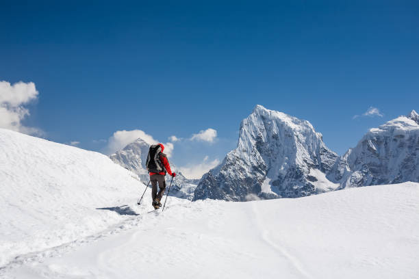
The alarm goes off in the dark at Dzongla. Outside the lodge, stars blaze over the frozen silhouette of Cholatse, and the only sounds are your boots crunching on frost and your guide and porters’ low voices. Ahead lies the most exciting day of many Everest treks: a steep climb through a rocky chute, a walk across a glacier beneath towering ice cliffs, and a dramatic descent into the Gokyo valley. By evening, you will have crossed from one great Khumbu valley to another.
This is Cho La Pass, at around 5,420 m, a high, glaciated pass linking the classic Everest Base Camp route with the turquoise Gokyo Lakes. It is the heart of our Everest 3 Pass Trek and the key to combining Everest Base Camp, Kala Patthar and Gokyo Ri in a single unforgettable journey.
In this guide, our Sherpa team shares everything you need to know about the Cho La Pass: where it is, how the crossing unfolds step by step, how difficult it really is, what gear you need, when to go, and how to acclimatise to fit it into your Everest adventure.
Cho La Pass at a Glance
Here are the essential facts before we explore the pass in detail:
- Altitude: About 5,420 m (around 17,780 ft).
- Location: Between the Khumbu Valley (on the Everest Base Camp side) and the Gokyo Valley, inside Sagarmatha National Park.
- East side: Dzongla, at about 4,830 m, reached from Lobuche or Dingboche.
- West side: Thangnak, also called Dragnag, at about 4,700 m, a short walk from Gokyo across the Ngozumpa Glacier.
- Crossing time: Usually seven to nine hours from Dzongla to Thangnak, depending on conditions and pace.
- Distance: Roughly 9 to 10 km from Dzongla to Thangnak, with an extra 4 km or so to Gokyo.
- Main features: A steep, rocky ascent; a small glacier near the top; and a steep, rocky descent on the western side.
- Difficulty: Strenuous, with some sections requiring care on ice and loose rock. Not technical climbing, but more demanding than a normal trekking day.
- Best seasons: Autumn (October to November) and spring (April to May).
- Treks that cross it: The Everest Three Passes Trek and combined Everest Base Camp and Gokyo Lakes treks.
Why Cross the Cho La Pass?
Most trekkers in the Everest region choose either the classic route to Everest Base Camp or the quieter trail to the Gokyo Lakes. The Cho La Pass lets you experience both on one journey, turning a there-and-back trek into a spectacular loop.
- See both great viewpoints: Climb Kala Patthar for the classic close-up of Everest and Gokyo Ri for the panorama of four 8,000 m peaks above the lakes. Our comparison of Gokyo Ri vs Kala Patthar explains what makes each special.
- Avoid retracing your steps: Instead of walking back down the same valley, you return through completely new scenery.
- Experience a true mountain pass: The glacier, ice cliffs and wild high-altitude landscape make the Cho La one of the most memorable days in the Himalaya.
- Fewer crowds: Once you leave the main Everest Base Camp trail, the number of trekkers drops dramatically.
- A sense of achievement: Crossing a 5,400 m glaciated pass feels like a real accomplishment and a perfect stepping stone toward peak climbing.
Where Is the Cho La Pass?
The Khumbu region is formed by several deep valleys running north to south, separated by high ridges. The Cho La Pass cuts through the ridge between the Khumbu valley, where the trail climbs past Dingboche, Lobuche and Gorakshep to Everest Base Camp, and the Gokyo valley, where the Dudh Koshi flows from the Ngozumpa Glacier past the Gokyo Lakes.
The pass lies beneath the dramatic peaks of Cholatse and Lobuche West, with the small Cho La glacier draped across its summit. On the eastern side, the trail rises from the summer pastures of Dzongla. On the western side, it drops steeply toward Thangnak, a small lodge settlement beside Ngozumpa Glacier, Nepal’s longest glacier.
Further south, two other high passes complete the circuit: Kongma La, between Chhukung and Lobuche, and Renjo La, between Gokyo and the Thame valley. Together, they form the famous Everest 3 Pass Trek.
Which Direction Should You Cross the Cho La Pass?
You can cross the Cho La Pass either way, but most trekkers go east to west, from Dzongla on the Everest side to Thangnak and Gokyo. There are good reasons for this:
- Better acclimatisation: After visiting Everest Base Camp and Kala Pattha, you are already well acclimatised at 5,500 m and above.
- Easier ascent: The eastern side climbs more gradually overall, while the western side is shorter but steeper. Descending the steep western side is easier than climbing it.
- Natural loop: You visit Everest Base Camp first and finish with the peaceful Gokyo Valley.
Crossing from west to east, from Gokyo to Dzongla, is also possible and suits some itineraries, such as when combining Gokyo first with the classic route afterwards. It means climbing the steep western slope, which is tiring but manageable with good acclimatisation. The team will recommend the best direction for your itinerary when you plan your trip.
The Approach: Lobuche to Dzongla
On the classic east-to-west route, the day before the crossing is short and gentle. From Lobuche, or from Dughla below it, the trail branches west from the main Everest Base Camp trail and contours along the hillside above the Khumbu Glacier.
Soon, the beautiful lake of Chola Tsho comes into view, lying beneath the immense north face of Cholatse and the shapely Awi Peak. Many trekkers consider this one of the most photogenic stretches of the whole trek. The trail then crosses a ridge and descends gently to Dzongla, a small cluster of lodges in a high pasture at about 4,830 m.
The walk from Lobuche to Dzongla takes about three to four hours. Use the afternoon to rest, drink plenty of fluids, eat well and prepare your gear for the pass. Go to bed early; you will start before dawn.
The Cho La Pass Crossing, Step by Step
Here is how a typical east-to-west crossing of the Cho La Pass unfolds. Times are approximate and depend on your pace, the weather and the conditions on the glacier.
Pre-Dawn Start from Dzongla
Most groups leave Dzongla between four and five in the morning, after a quick breakfast and hot drink. Starting early is important: the snow and ice are firmer in the cold morning, rockfall is less likely before the sun warms the slopes, and you will have enough daylight to reach Thangnak or Gokyo. Wear warm layers, gloves and a hat, and switch on your headlamp.
The Gentle Valley Walk
The first part of the route is relatively easy. The trail crosses a flat, grassy valley floor and follows a stream westwards, with Cholatse towering to the south and the pass ahead. As the first light touches the peaks, the views back towards Ama Dablam and the Khumbu are beautiful.
The Steep Rocky Ascent
The real climb begins as the trail turns up a steep slope of boulders and scree. The path zigzags up through a rocky gully, sometimes requiring you to use your hands on large rocks. Cairns and prayer flags mark the way, but route-finding can be tricky in snow or poor visibility- one reason to cross with an experienced guide. This section is steep and tiring at altitude; take it slowly and keep a steady rhythm.
Onto the Cho La Glacier
Near the top of the rocky ascent, you reach the edge of the small Cho La glacier, which covers the final approach to the pass. The route crosses the glacier on a gentle slope for about twenty to forty minutes. Depending on the season and recent snowfall, the surface can be firm snow, slippery ice or patches of both. Microspikes or crampons are often essential here. Stay on the established route, follow your guide’s footsteps and watch for crevasses in unusual snow conditions. With ice cliffs and snowy peaks all around, this glacier walk is one of the trek’s most beautiful sections.
The Summit of the Cho La Pass
At around 5,420 m, the Cho La Pass summit is marked by colourful prayer flags snapping in the wind. Most groups reach it about three to five hours after leaving Dzongla. Views stretch over the glacier and toward the Gokyo Valley peaks to the west and the Khumbu to the east. Take a short break, eat a snack, drink some water, and enjoy the moment, but don’t linger too long in the cold wind.
The Steep Descent to the West
The western descent is the most challenging part of the day for many trekkers. The trail drops steeply over loose rock and boulders, sometimes covered in snow or ice in the early season. Use your trekking poles, test each step, and keep a safe distance from others to avoid dislodging rocks onto people below. Rockfall can be a hazard here, especially later in the day as the sun loosens rocks from the cliffs above. Your guide will set a careful, steady pace.
Down the Valley to Thangnak
After the steep section, the trail eases and gradually descends along a stream, past moraines and grassy slopes, to Thangnak (also known as Dragnag) at about 4,700 m. Most trekkers arrive in the early to mid-afternoon, tired but elated. Many itineraries stop here for the night; others continue to Gokyo the same day.
Thangnak to Gokyo Across the Ngozumpa Glacier
From Thangnak, the trail crosses the Ngozumpa Glacier to reach Gokyo, a journey of about two to three hours. The glacier here is a vast expanse of rock-covered ice, dotted with meltwater ponds and grey moraine ridges. The trail changes with the seasons as the glacier moves, so follow your guide carefully. On the far side, you climb over the lateral moraine and suddenly see the turquoise waters of Dudh Pokhari and Gokyo village on its shore.
How Difficult Is the Cho La Pass?
The Cho La Pass is one of the most demanding days on any Everest region trek. It is not technical mountaineering, and it does not require ropes in normal conditions, but it combines several challenges:
- Altitude: At about 5,420 m, the air carries roughly half the oxygen of sea level. Every step requires effort.
- Long day: Seven to nine hours of walking, and longer if you continue to Gokyo.
- Steep, rocky terrain: Both sides involve steep climbs or descents over boulders and loose scree.
- Glacier crossing: Snow and ice require careful footwork and often microspikes or crampons.
- Weather: Snow, wind and cold can make conditions much harder and occasionally close the pass.
- Rockfall: Loose rocks from the cliffs above are a real hazard, particularly in the afternoon.
Of the three high passes in the Everest region, many trekkers rate Kongma La as the longest and most strenuous, Renjo La as the most gradual with the best views, and Cho La as the most technical because of its glacier. Fit, well-acclimatised trekkers with an experienced guide cross it safely every season. For a broader look at preparing for the Khumbu, read our guide to Everest Base Camp Trek difficulty.
Cho La vs Kongma La vs Renjo La: The Three Passes Compared
The Cho La Pass is one of three high passes in the Everest region. If you are considering the full circuit, it helps to understand how they differ:
- Kongma La (about 5,535 m): The highest and easternmost pass, linking Chhukung with Lobuche. It is long and steep, with a tiring scramble up loose rock and a descent across the Khumbu Glacier. Many trekkers consider it the most strenuous, but its summit views over Island Peak, Makalu and the Imja valley are spectacular.
- Cho La (about 5,420 m): The middle pass and the most frequently crossed. It is shorter than Kongma La but the most technical of the three, thanks to its glacier and steep, rocky western side.
- Renjo La (about 5,360 m): The westernmost pass, linking Gokyo with the remote Thame valley. A long, steady climb up a well-built stone staircase leads to one of the finest views in the Himalaya, looking back over the Gokyo Lakes, the Ngozumpa Glacier, and Everest.
Crossing all three requires around three weeks, excellent fitness, and careful acclimatisation; trekkers start with the Cho La Pass alone and return later for the full circuit. Our Everest 3 Pass Trek includes extra acclimatisation to make the journey safer and more enjoyable.
How to Train for the Cho La Pass
Because the Cho La Pass is longer and steeper than a normal trekking day, good preparation pays off. Begin training at least three months before your trek:
- Long hikes with a pack: Walk five to eight hours on hilly terrain with a 6 to 8 kg daypack, ideally on consecutive days.
- Steep climbs: Train on stairs, steep hills or an incline treadmill to prepare for the rocky ascent.
- Downhill practice: Steep descents prepare your knees and quads for the western side of the pass.
- Leg and core strength: Squats, lunges, step-ups and core exercises improve stability on uneven ground.
- Balance work: Walking on uneven trails or doing balance exercises helps on boulders and ice.
- Practise with microspikes: If possible, walk in microspikes on snow or ice before your trip to get used to them.
If you have never trekked at high altitude before, consider gaining experience on a classic route first, such as the Everest Base Camp Trek, the Annapurna Base Camp Trek or the Langtang Valley Trek. For other demanding passes in Nepal, see the Annapurna Circuit Trek over the Thorong La, or the Manaslu Circuit Trek over the Larke Pass.
Gear for the Cho La Pass
Proper equipment makes the Cho La Pass safer and more enjoyable. In addition to standard trekking gear, our guides check these items before the crossing:
- Microspikes or crampons: Essential on the icy glacier and frozen sections in most seasons. You can usually buy or rent microspikes in Namche Bazaar; your guide will advise on conditions.
- Sturdy waterproof boots: With good ankle support and stiff soles that fit microspikes or crampons.
- Trekking poles: Very helpful for balance on the steep descent and the glacier.
- Warm layers: Thermal base layers, fleece, down jacket and windproof shell for the cold pre-dawn start and windy summit.
- Gloves and liners: Insulated gloves for the cold, with thin liners for dexterity.
- Warm hat, buff and sun hat: For cold mornings and intense sun on the glacier.
- Glacier-quality sunglasses: Category 3 or 4 lenses to protect against snow blindness.
- Headlamp with spare batteries: For the pre-dawn start.
- Water and snacks: At least two litres of water in insulated bottles, plus energy-rich snacks. No teahouses between Dzongla and Thangnak.
- Sunscreen and lip balm: The sun on snow and ice is extremely strong.
- First aid kit: Including blister care and personal medication.
Our full trekking equipment list covers everything you need for the whole trek.
Best Time to Cross the Cho La Pass
Weather and season strongly affect conditions at the Cho La Pass.
Autumn (October to November)
The best season for most trekkers. After the monsoon, skies are clear and stable, and the pass is usually in good condition, though ice can form on the glacier and early snowfalls are possible. Nights are very cold, especially in late November.
Spring (April to May)
Another excellent season, with warmer temperatures and long days. Winter snow may still cover parts of the route in early spring, making the glacier and descent slippery. Afternoon clouds and occasional snow showers are common.
Early Spring and Late Autumn (March and December)
Possible but more challenging. Snow and ice are more likely, and conditions change quickly. Experienced trekkers with good gear and flexible itineraries can cross, but the pass may sometimes be closed.
Winter (January to February)
Heavy snow and extreme cold often make the Cho La Pass dangerous or impassable. Most lodges at Dzongla and Thangnak close. We do not recommend crossing in mid-winter.
Monsoon (June to September)
Rain lower down and snow higher up, with cloud, poor visibility and an increased risk of rockfall. Not recommended for most trekkers.
Acclimatisation Before the Cho La Pass
Acclimatisation to a safe, successful crossing. Never attempt the Cho La Pass without having spent several days above 4,000 m first.
- Namche Bazaar: Spend two nights, with a hike to the Hotel Everest View and Khumjung and Khunde.
- Dingboche or Chhukung: Spend two nights in the Imja Valley with an acclimatisation hike to Nangkartshang or Chhukung Ri.
- Everest Base Camp and Kala Patthar first: On the classic east-to-west route, visiting Everest Base Camp and Kala Patthar before the pass ensures you are well adapted to altitudes above 5,000 m.
- Gokyo first: If crossing west to east, spend time in Gokyo and climb Gokyo Ri before attempting the pass.
Know the signs of altitude sickness, including headache, nausea, dizziness and unusual fatigue, and never ascend with symptoms. Our Acute Mountain Sickness guide explains prevention and warning signs, and our guide to Pheriche and the HRA aid post describes medical help in the Khumbu.
Safety on the Cho La Pass
Safety is our top priority on every crossing. Our guides follow these principles on the Cho La Pass:
- Check conditions: We gather the latest information on snow, ice and weather from lodges and other guides before committing to the crossing.
- Start early: An early start means firmer snow, less rockfall and more daylight.
- Never cross alone: Always cross the pass with an experienced guide, especially in snow or poor visibility.
- Be ready to turn back: If the weather turns or conditions are dangerous, we turn back or wait a day. The mountain will still be there.
- Respect rockfall zones: Move steadily through areas below cliffs and avoid stopping in exposed spots.
- Use the right equipment: Wear microspikes or crampons on ice, and carry trekking poles for balance.
- Stay together: Groups move at the pace of the slowest member.
- Carry insurance: Travel insurance covering high-altitude helicopter evacuation is essential.
Our guides are experienced in high-altitude trekking and first aid, and they carry communication devices for emergencies. Meet the people who lead our treks on our Our Team page.
Treks That Include the Cho La Pass
Several options include the Cho La Pass in your Everest adventure.
Everest 3 Pass Trek
This ultimate Everest region trek crosses Kongma La, Cho La, and Renjo La, visiting Everest Base Camp, Kala Patthar, Gokyo Ri, and the Thame Valley. It takes around three weeks and suits fit, experienced trekkers. See our Everest 3 Pass Trek for details.
Everest Base Camp and Gokyo Lakes via Cho La
A slightly shorter loop links the classic Everest Base Camp Trek with the Gokyo Lakes Trek by crossing only the Cho La. It usually takes 16 to 18 days and offers two of the region’s best viewpoints.
Combining with Peak Climbing
The Cho La makes excellent preparation for a trekking peak. Climbers often combine it with Lobuche Peak Climbing or Island Peak Climbing. Lobuche East rises directly above the approach to Dzongla.
The Historic Approach
For a truly epic journey, start on foot from Jiri, follow the historic expedition route, join the Khumbu, and cross the Cho La. Our Jiri to Everest Base Camp trek guide covers the lower section, and you can extend it with the pass.
Sample Itinerary: Everest Base Camp and Gokyo via Cho La
Here is an example of how our team plans a combined trek with the Cho La Pass, crossing from east to west:
- Day 1: Arrive in Kathmandu and prepare for the trek.
- Day 2: Fly to Lukla and walk to Phakding. Read our guide to Phakding and Monjo.
- Day 3: Trek to Namche Bazaar.
- Day Acclimatisation in Namche.
- Day 5: Trek to Tengboche and visit the monastery.
- Day 6: Trek through Pangboche to Dingboche.
- Day 7: Acclimatisation in Dingboche.
- Day 8: Trek to Lobuche.
- Day 9: Trek to Gorakshep and Everest Base Camp.
- Day 10: Sunrise on Kala Patthar, then descend to Lobuche or Dzongla.
- Day 11: Trek to Dzongla, or rest if you reached it the day before.
- Day 12: Cross the Cho La Pass to Thangnak.
- Day 13: Cross the Ngozumpa Glacier to Gokyo.
- Day 14: Climb Gokyo Ri at sunrise and explore the lakes.
- Day 15: Descend to Dole or Machhermo.
- Day 16: Trek back to Namche Bazaar.
- Day 17: Trek to Lukla.
- Day 18: Fly back to Kathmandu.
Keep at least one or two buffer days for weather on the pass and Lukla flight delays.
Life at Dzongla and Thangnak
The two small settlements on either side of the Cho La Pass are part of the adventure.
Dzongla
Dzongla is a cluster of simple lodges on a high pasture beneath Cholatse and Lobuche peaks. It began as a summer yak-herding settlement and now serves trekkers heading for the pass. Rooms are basic and cold, but the dining rooms are warm, and the views are spectacular, especially at sunset when Ama Dablam and Cholatse glow pink.
Thangnak
Thangnak, or Dragnag, sits at the foot of the pass beside the Ngozumpa Glacier’s lateral moraine. Its few lodges welcome tired trekkers, and many celebrate their crossing here with a hot meal and plenty of tea. The next morning, the short crossing to Gokyo brings you to the sacred lakes.
Both settlements have limited facilities, with simple meals, shared toilets and limited charging. Bring a warm sleeping bag rated to well below freezing, and a power bank for your devices.
Highlights on Both Sides of the Pass
The Cho La Pass connects two of the most beautiful valleys in the Himalaya, each full of highlights.
The Khumbu Side
- Everest Base Camp: The foot of the Khumbu Icefall, where Everest expeditions begin.
- Kala Patthar: The classic sunrise or sunset view of Everest.
- Chola Tsho: A beautiful lake beneath Cholatse on the way to Dzongla.
- Thukla memorials: Moving stone memorials honouring climbers and Sherpas lost on Everest.
- Monasteries and villages: Tengboche, Pangboche, and the Sherpa villages below. Learn more in our guides to Tengboche Monastery, the Mani Rimdu festival, and Sherpa culture and traditions.
The Gokyo Side
- Gokyo Lakes: A chain of sacred turquoise lakes, protected as a wetland of international importance.
- Gokyo Ri: A panorama of Everest, Lhotse, Makalu and Cho Oyu above the lakes.
- Ngozumpa Glacier: The longest glacier in Nepal.
- Fourth and fifth lakes: Quiet lakes north of Gokyo with close views of Cho Oyu.
- Renjo La: On the Three Passes route, a high pass with a stunning view back over Gokyo and Everest.
For an aerial view of the Gokyo side, the Gokyo Lakes Helicopter Tour flies over the lakes and glacier in a single day.
Common Mistakes on the Cho La Pass
Our guides see the same avoidable mistakes every season:
- Attempting the pass too early in the trek: Without proper acclimatisation, it can be dangerous. Cross it only after several days above 4,000 m.
- Starting too late: Late starts mean softer snow, more rockfall and the risk of finishing in the dark.
- Leaving microspikes behind: Even in autumn, the glacier can be icy. Carry microspikes and ask your guide about conditions.
- Crossing without a guide: Route-finding can be difficult in snow or cloud, and accidents are more serious in remote areas.
- Ignoring the weather: Heavy snow, strong wind or poor visibility are reasons to wait or turn back.
- Carrying too much: Keep your daypack light and let porters carry the rest.
- Not drinking or eating enough: A long day at altitude needs plenty of fuel and fluids.
Luxury and Helicopter Options
The Cho La Pass itself must be crossed on foot, but you can add comfort and flexibility around it:
- Better lodges lower down: Combine your crossing with the comfortable lodges used on our Everest Base Camp Luxury Lodge Trek in Namche and other villages.
- Fly out from Gokyo: After crossing the pass and climbing Gokyo Ri, a helicopter can return you to Lukla or Kathmandu, saving several days of descent, similar to our Luxury Everest Base Camp Trek with Helicopter Return.
- Premium heli trekking: The Everest Elite Luxury Heli Trek offers a luxurious, shorter way to explore the Khumbu without crossing high passes.
Helicopter landings at high altitude follow specific rules. Our blog on Everest helicopter tour restrictions explains more.
Permits for the Cho La Pass Route
You don’t need a special permit for the Cho La Pass itself. Like all Everest region treks, you need the Sagarmatha National Park entry permit and the Khumbu Pasang Lhamu Rural Municipality permit, which our team arranges for you. Nepal also requires foreign trekkers to walk with a licensed guide in most trekking areas. You will need a Nepal visa, which most nationalities can get on arrival; see our Nepal visa guide.
Frequently Asked Questions About the Cho La Pass
How high is the Cho La Pass?
The Cho La Pass is about 5,420 m (around 17,780 ft) above sea level.
How long does it take to cross the Cho La Pass?
Crossing from Dzongla to Thangnak usually takes seven to nine hours, depending on conditions and pace. Continuing to Gokyo adds about two to three hours.
Is the Cho La Pass dangerous?
It is demanding rather than technical, but hazards include glacier ice, steep loose rock, and occasional rockfall. With good acclimatisation, gear, an early start, and an experienced guide, many trekkers cross it safely each season.
Do I need crampons for the Cho La Pass?
Microspikes or crampons are often needed on the glacier and icy sections, especially in spring and late autumn. Your guide will advise based on current conditions.
Which direction is best for crossing the Cho La?
Most trekkers cross from east to west, from Dzongla to Gokyo, after visiting Everest Base Camp. This offers better acclimatisation and an easier ascent, with the steeper side as the descent.
Can beginners cross the Cho La Pass?
It suits trekkers with some high-altitude experience. Beginners should consider the classic Everest Base Camp or Gokyo Lakes trek first.
When is the Cho La Pass closed?
Heavy snow can close the pass, most often in winter and sometimes after storms in other seasons. Always check conditions before crossing.
How does the Cho La compare with Kongma La and Renjo La?
Kongma La is often considered the longest and most strenuous, Renjo La the most gradual with the best views, and Cho La the most technical because of its glacier.
Do I need a special permit for the Cho La Pass?
No. The standard Sagarmatha National Park and Khumbu Pasang Lhamu Rural Municipality permits cover the route.
Can I combine Everest Base Camp and Gokyo Lakes without the Cho La?
Yes, you can descend from the Everest side toward Namche and walk up the Gokyo Valley, but it takes longer and involves retracing your steps. The Cho La is the most direct and scenic link.
Final Thoughts: The Crossing That Connects the Khumbu
The Cho La Pass is where an Everest trek becomes an expedition. In a single day, you climb from the high pastures of Dzongla through a rocky gully, cross a glistening glacier beneath ice cliffs and descend into the wild Gokyo valley. It links the two greatest viewpoints in the Himalaya and rewards you with a lifetime of achievement.
Let our experienced Sherpa guides lead you safely across. Join our Everest 3 Pass Trek, combine the Everest Base Camp Trek with the Gokyo Lakes Trek via the Cho La, or ask us to design your perfect route. Plan your trip or contact us today, and cross the pass that connects the Khumbu.
Quick Inquiry
Explore More


