
Chhukung Valley and Chhukung Ri: Best Side Hike from Dingboche
Chhukung Valley and Chhukung Ri: Best Side Hike from Dingboche
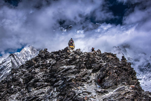
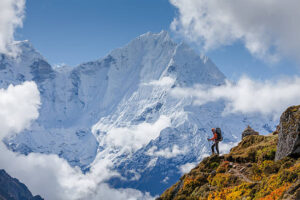
The wind drops as the sun reaches the rocky summit In front of you, so close it seems to fill half the sky, rises the colossal south face of Lhotse, a wall of ice and rock more than three kilometres high To the right, the snowy pyramid of Island Peak stands above a tangle of glaciers and a milky turquoise lake; behind you, Ama Dablam shows a side of itself most trekkers never see; and far to the east, the granite tower of Makalu glows in the morning light You are standing on Chhukung Ri, at about 5,550 m, and you have the view almost to yourself.
Chhukung Ri and the quiet Chhukung Valley are the Everest region’s best-kept secret. Just a few hours’ walk east of Dingboche, the valley leads into a world of glaciers and giant peaks that the main base camp trail never shows. It is a superb acclimatization hike, a base for Island Peak climbers and the starting point for the first of the high passes on our Everest 3 Pass Trek.
In this guide, our team explains everything you need to know: where the valley is, the walk from Dingboche, Chhukung village, the climb of Chhukung Ri, what you see from the top, other side trips, how Chhukung fits into the Three Passes and Everest Base Camp treks, altitude safety and the best time to go.
The Short Answer: What Is the Chhukung Ri Side Hike?
Chhukung Ri, about 5,550 m, is a non-technical peak above Chhukung village, about 4,730 m, at the head of the Imja valley, a two- to three-hour walk east of Dingboche. The climb gains about 820 m in two and a half to three and a half hours, ending with a short rocky scramble, and rewards you with close views of the Lhotse south face, Island Peak, Makalu and Ama Dablam.
In brief:
- Where: The Chhukung Valley, east of Dingboche in the Everest region.
- How long: Two to three hours from Dingboche to Chhukung, then four to six hours for the round trip on Chhukung Ri.
- How hard: Steep and high, with a short scramble at the top, but no ropes or technical skills needed.
- Why go: Some of the closest and most dramatic mountain views in the Khumbu, with far fewer trekkers.
Chhukung Ri and the Chhukung Valley at a Glance
- Dingboche: About 4,410 m, the starting point.
- Chhukung village: About 4,730 m; around 4.5 to 5 km and two to three hours from Dingboche.
- Chhukung Ri: About 5,550 m; a gain of about 820 m from Chhukung.
- Time on Chhukung Ri: Two and a half to three and a half hours up and one and a half to two hours down.
- Difficulty: Strenuous because of the altitude, with a short scramble near the summit.
- Permits: The standard Sagarmatha National Park and municipality permits; no extra permit is normally needed.
- Best seasons: Spring and autumn.
- Main views: Lhotse south face, Nuptse, Island Peak, Ama Dablam, Makalu, Baruntse and the Imja glaciers.
- Our trek: The 21-day Everest 3 Pass Trek, which includes a night in Chhukung and the climb of Chhukung Ri.
Where Is the Chhukung Valley?
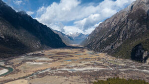
The Chhukung Valley is the upper part of the Imja valley, one of the four great valleys of the Khumbu. At its mouth stands Dingboche, the stone-walled village where most Everest Base Camp trekkers spend two nights acclimatising. From there, the valley runs east and north-east, past the herders’ settlement of Bibre, to Chhukung, a small cluster of lodges at the foot of the great Lhotse–Nuptse wall.
Beyond Chhukung lie the Lhotse and Imja glaciers, the glacial lake of Imja Tsho, the base camp for Island Peak and, further still, the high and serious Amphu Lapcha pass, which leads over into the remote Hongu valley. To the north-west, the Kongma La links Chhukung with Lobuche and the Khumbu Glacier. The whole valley lies within Sagarmatha National Park.
Getting to Dingboche: The Classic Approach
Every journey to Chhukung Ri begins on the classic Everest trail. After the flight to Lukla, you walk along the Dudh Koshi to Phakding, climb to Namche Bazaar and spend an acclimatisation day hiking to Hotel Everest View and the Sherpa villages of Khumung and Khunde. From Namche, the trail continues to Tengboche, through Pangboche and up into the Imja valley to Dingboche, usually reached on the sixth or seventh day of the trek.
Prefer to walk in from the lower hills? The classic Jiri to Everest Trek, described in our Jiri to Everest Base Camp guide, and the Everest Base Camp Trek by Road avoid the Lukla flight and give extra time to acclimatise. First-time trekkers should also read our guide to the Everest Base Camp Trek for beginners, and older trekkers our guide to the Everest Base Camp Trek over 50.
Why the Chhukung Valley Is the Best Side Hike from Dingboche
Most trekkers on the classic route spend their acclimatisation day in Dingboche climbing the ridge of Nangkartshang behind the village. It is an excellent hike, but the Chhukung Valley offers something different.
- The giants up close: Lhotse, Nuptse, Island Peak and Ama Dablam tower directly above the valley.
- Peace: Far fewer trekkers walk this way, especially beyond Chhukung.
- Perfect acclimatisation: A walk to Chhukung, or a night there with the climb of Chhukung Ri, builds altitude gradually before Everest Base Camp or the high passes.
- Flexibility: It can be a half-day walk, a full-day hike, or a two-day side trip.
- Glacier scenery: Moraine ridges, icefalls and turquoise lakes create one of the wildest landscapes in Nepal.
Dingboche to Chhukung: The Trail
The walk from Dingboche to Chhukung is one of the most beautiful easy walks in the Khumbu, covering about 4.5 to 5 km with a net gain of about 320 m in two to three hours.
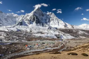
Leaving the stone-walled fields of Dingboche, the trail follows the northern side of the Imja Khola, gaining height gently across open pastures dotted with stone huts and grazing yaks. Behind you, Ama Dablam reveals its less familiar northern and eastern faces; ahead, the Lhotse–Nuptse wall grows ever larger. After the small seasonal settlement of Bibre, the path crosses streams flowing down from the glaciers and climbs gently over old moraine to Chukung. Near the trail, memorial stones remember climbers who lost their lives on the Great South Face.
Tip: start after breakfast, walk slowly and enjoy the views. No need to rush; the short day is part of your acclimatisation.
Chhukung Village
Chhukung, at about 4,730 m, is a small settlement of lodges built around the Imja Valley’s old summer pastures. It is the last overnight stop for trekkers heading over the Kongma La and the gathering point for climbers bound for Island Peak, so in spring and autumn its dining rooms are full of climbing gear, expedition talk and the smell of yak-dung stoves.
Lodges are simple but welcoming, with warm dining rooms, basic twin rooms, and mostly shared bathrooms. Nights are very cold at this altitude, so a good sleeping bag is essential. In the coldest weeks of winter and during the monsoon, some lodges close, so our team always confirms what is open before you arrive.
Menus are simple but filling: dal bhat, noodle soups, fried rice, potatoes, eggs, and pancakes, with plenty of hot tea and ginger-and-lemon drinks to keep you keepated. We recommend vegetarian meals at this altitude, as meat has been carried up from lower valleys for days. Always treat or boil your drinking water, and fill an insulated bottle with hot water in the evening to warm y ur sleeping bag. Charging and hot showers are limited at this altitude, so bring a power bank and enjoy the simplicity.
Climbing Chhukung Ri
Climbing Chhukung Ri is the highlight of any visit to the valley, and one of the finest viewpoints in the whole Everest region.
The Route
The trail starts just behind Chhukung village, crosses a stream on rocks, and follows a sandy path into a side valley before turning uphill. From here, it climbs steadily, with very few flat sections, up grassy and stony slopes and along a broad ridge. Near the top, the ridge levels briefly before a short, rocky final section where you may need to use your hands. The summit is marked with th prayer flags. You descend by the same route.
How Long and How Hard Is It?
Most trekkers take two and a half to three and a half hours to climb Chhukung Ri from Chhukung and one and a half to two hours to descend, for a round trip of f ur to six hours. The climb gains about 820 m, from about 4,730 m to about 5,550 m, almost exactly the height of Kala Patthar. It is not technical, but the gradient and the thin air make it a serious effort, and the final scramble needs care, especially when the rocks are icy or the wind is strong. Your guide will judge whether conditions are safe to continue to the highest point.
The View from the Top
The panorama from Chhukung Ri is completely different from the classic views of the base camp trail, because it puts you right in front of the southern wall of the Everest massif:
- Lhotse (about 8,516 m): The world’s fourth-highest mountain, with its immense south face rising more than 3,000 m directly above the valley.
- Nuptse (about 7,861 m) and Lhotse Shar: Continuing the great wall to the west and east.
- Island Peak (about 6,189 m): The popular climbing peak, rising from the Imja and Lhotse glaciers.
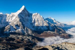
- Ama Dablam (about 6,812 m): Seen from an unusual angle, its northern ridges and hanging glaciers sharp against the sky.
- Makalu (about 8,485 m): The world’s fifth-highest mountain, far to the east.
- Baruntse and the peaks of the Hongu: A wall of snow peaks around the head of the valley.
- Imja Tsho: The large glacial lake below Island Peak, milky turquoise against the grey moraines.
Everest itself is hidden behind the Lhotse–Nuptse wall, which is part of what makes the view so unusual: you see the massif’s vast scale from below, rather than its summit from afar. Our article on Nepal’s eight-thousand-metre peaks introduces the giants, and our guide to Ama Dablam tells the story of the valley’s most beautiful mountain.
Sunrise or Morning Climb?
Unlike Kala Patthar and Gokyo Ri, trekkers usually don’t climb Chhukung Ri in the dark for sunrise. Lhotse’s great south face rises to the north, and the early sun lights the peaks around the valley soon after dawn, so most trekkers leave Chhukung at first light or shortly after an early breakfast and reach the summit by mid-morning, when the views are usually clearest. Climbing a little later also means warmer rock on the final scramble. Your guide will choose the best start time based on the season and weather.
Tips for the Climb
- Start early: Mornings are clearer and calmer; clouds and wind often build after midday.
- Dress warmly: The summit can be bitterly cold and windy, even on a sunny day.
- Carry water and snacks: At least two litres of water and some energy food.
- Use trekking poles: They help on the steep ascent and the loose descent; stow them for the final scramble.
- Turn back if needed: A worsening headache, nausea or dizziness means descend.
Is a Permit Needed?
For trekkers, Chhukung Ri is treated as a viewpoint hike. You normally don’t need an extra permit beyond the Sagarmatha National Park entry permit, and the Khumbu Pasang Lhamu Rural Municipality permit you already hold for the trek. Rules can change, so our team always checks the latest requirements.
The Lhotse South Face: A Wall of Legends
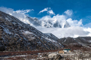
The great wall that dominates the Chhukung Valley is Lhotse’s south face, one of the largest and steepest mountain faces on Earth, rising more than 3,000 m from the glaciers to the summit ridge. For decades, it was regarded as one of the ultimate challenges of Himalayan climbing, the scene of many famous attempts before it was finally climbed, and the site where some of the greatest mountaineers of their generation lost their lives on its ice and rock.
From Chhukung and the summit of Chhukung Ri, you look straight up at this wall, watching avalanches pour down its gullies and clouds form and dissolve along its crest. It is a humbling sight, and a reminder of why the memorial stones along the trail are treated with such respect. Our article on Nepal’s eight-thousand-metre peaks tells more of the story of Lhotse and its neighbours.
A Two-Day Chhukung Side Trip: Sample Plan
For trekkers on the classic base camp route who want to add the valley, this is the simplest plan, after two nights at Dingboche:
- Day one: Walk from Dingboche to Chhukung in two to three hours. Settle into your lodge, have lunch and, if you feel well, take a short afternoon walk onto the moraine for views of the Lhotse and Nuptse icefalls: early dinner and an early night.
- Day two: Climb Chhukung Ri at first light, return to Chhukung for a late breakfast, then walk back down the valley to Dingboche, or on towards Pheriche, ready to continue to Lobuche the next day.
On the Three Passes route, day two ends instead with a rest in Chhukung before the early start for the Kongma La. Either way, the extra height you gain on Chhukung Ri helps your body prepare for Everest Base Camp, Kala Patthar and the high passes.
Other Side Trips from Chhukung
Island Peak Base Camp and Imja Tsho
A walk of around two and a half to three hours east of Chhukung, along the moraines of the Lhotse and Imja glaciers, leads to Island Peak Base Camp, at about 5,087 m, beneath the mountain’s rocky south-west ridge. Nearby lies Imja Tsho, one of the fastest-growing glacial lakes in the Himalaya, whose water level was lowered by an engineering project to reduce the risk of a glacial lake outburst flood. It is a long but rewarding day, and climbers use the route on their way to the summit of Island Peak, described in our Island Peak climbing guide.
Glacier Viewpoints Above Chhukung
Shorter walks onto the moraines around Chhukung give close views of the icefalls tumbling from Lhotse and Nuptse. They make a good half-day outing on a rest day or for anyone who prefers not to climb Chhukung Ri. Always stay on established paths, as the moraines can be loose and unstable.
Chhukung Ri as a Day Hike from Dingboche
Strong, well-acclimatised trekkers sometimes climb Chhukung Ri in a single day from Dingboche. It is a big outing, with around 1,150 m of ascent and eight to ten hours of walking, and it should only be attempted after at least two nights at Dingboche, with an early start, settled weather and a firm turnaround time.
For most trekkers, better options exist. On a Dingboche acclimatisation day, a walk to Chhukung and back (about five hours total) offers superb views and serves as acclimatisation. If you want to climb Chhukung Ri, sleep a night in Chhukung first and climb it the following morning.
Chhukung Ri vs Nangkartshang: Which Acclimatisation Hike?
- Nangkartshang: A steep ridge directly behind Dingboche, reaching around 5,000 m and more; three to four hours round trip; views of Makalu, Lhotse, Island Peak and Ama Dablam.
- Chhukung Ri: About 5,550 m; a longer outing from Chhukung or a very long day from Dingboche; the closest views of the Lhotse south face and Island Peak.
- Our advice: On the classic base camp trek, Nangkartshang is the natural choice for the Dingboche rest day. If you have one or two extra days, or you are crossing the Kongma La, a night in Chhukung and the climb of Chhukung Ri is the better, more rewarding option.
Chhukung on the Everest Three Passes Trek
On our 21-day Everest 3 Pass Trek, the Chhukung Valley plays a key role After acclimatizing in Dingboche, you walk to Chhukung, climb Chhukung Ri the next morning and, the following day, cross the Kongma La, at about 5,535 m, the highest of the three passes, to Lobuche The climb of Chhukung Ri is ideal preparation, taking you to the same altitude as the pass the day before you cross it.
From Lobuche, the route continues to Everest Base Camp and Kala Patthar, crosses Cho La to Gokyo, and finishes over Renjo La. Our Everest Three Passes Trek guide describes the full route, our Cho La Pass guide covers the second pass, and our guide to Gokyo Ri and Fifth Lake explains the hikes above Gokyo.
Adding Chhukung to the Everest Base Camp Trek
You do not need to cross the high passes to enjoy the Chhukung Valley. On the classic Everest Base Camp Trek, you can add one or two days at Dingboche: walk to Chhukung and sleep there, climb Chhukung Ri the next morning, then return to Dingboche and continue to Lobuche, Gorakshep, Everest Base Camp and Kala Patthar. The extra time also improves your acclimatisation for the highest days of the trek.
Our guides to the Everest Base Camp Trek 14-day itinerary, how many days the EBC trek takes, the Everest Base Camp Trek itinerary and the Everest Base Camp Trek distance show how to fit extra days into your plans. For more comfort, our Everest Base Camp Luxury Lodge Trek and the Luxury Everest Base Camp Trek with Helicopter Return can also be tailored to include Chhukung.
Altitude and Safety in the Chhukung Valley
Chhukung sits at about 4,730 m, and Chhukung Ri reaches about 5,550 m, so visit the valley only after proper acclimatisation.
- Acclimatise first: Spend at least two nights at Dingboche before sleeping at Chhukung.
- Know the warning signs: Headache, nausea, dizziness, unusual tiredness, loss of balance or breathlessness at rest; tell your guide immediately.
- Never go higher with symptoms: If they worsen, descend to Dingboche or lower.
- Help nearby: The Himalayan Rescue Association aid post at Pheriche, just over the ridge from Dingboche, offers medical care in the main seasons, and helicopter evacuation is possible in good weather.
- Insurance: Choose a policy that covers trekking to at least 5,600 m and helicopter rescue.
Read our Acute Mountain Sickness page and our guide to altitude sickness on the Everest Base Camp Trek before you go.
Best Time to Hike Chhukung Ri
Spring and autumn are the best seasons for the Everest Base Camp Trek. e Chhukung Valley Our month-by-month guide to the best time for Everest Base Camp Trek applies here too.
- Autumn (late September to November): Clear, stable skies and the sharpest views of the Lhotse wall; read our guide to the Everest Base Camp Trek in October.
- Spring (March to May): Warmer, with busy climbing camps at Island Peak and more afternoon cloud; read our guide to the Everest Base Camp Trek in April.
- Winter (December to February): Very cold and often windy, with snow possible on the ridge; some lodges close.
- Monsoon (June to August): Cloudy, with limited views and fewer lodges open; read our guide to the Everest Base Camp Trek in the monsoon.
Photography in the Chhukung Valley
- Morning light on Ama Dablam: Shoot back down the valley from the trail near Bibre.
- The Lhotse wall at sunset: From Chhukung, the face catches the last light of the day.
- Island Peak and Imja Tsho: A wide-angle shot from Chhukung Ri captures the peak, the glaciers and the lake together.
- Summit panorama: Stitch several frames together to capture the full sweep from Nuptse to Makalu.
- Night skies: Chhukung’s high, dark skies are wonderful for star photography on clear nights.
Keep your batteries warm in an inside pocket; at this altitude, the cold drains them quickly.
What to Pack for the Side Hike
- Warm layers: A down jacket, hat, gloves and a windproof shell.
- Water and snacks: At least two litres of water and energy food.
- Sun protection: Glacier-grade sunglasses, sunscreen and lip balm.
- Trekking poles: For the steep climb and descent.
- Microspikes: Useful after fresh snow or on icy rock in the colder months.
- Headtorch and camera: For early starts and the summit views.
For the full list, see our Everest Base Camp Trek packing list and our trekking equipment page.
Nature and Wildlife in the Imja Valley
Above the tree line, the Imja Valley is a high-alpine world of grassland and juniper scrub. Himalayan tahr graze the slopes above; Tibetan snowcocks call from the hillsides, and lammergeiers and yaks graze the summer pastures around. In Chhukung, in summer, the meadows bloom with small alpine flowers. The elusive snow leopard also lives in these mountains, although sightings are extremely rare.
Culture: The Herders of the Imja Valley
Dingboche and Chhukung began as summer settlements, where Sherpa families from lower villages such as Pangboche brought their yaks to graze and grew potatoes and barley in one-walled fields. These families still run lodges in the valley. On the way up from Tengboche, the ancient monastery of Pangboche and the great monastery of Tengboche, described in our guide to Tengboche Monastery and the Mani Rimdu festival, show the region’s spiritual heart.
Our guide to Sherpa culture and traditions explains the beliefs of the people of the Khumbu, our article on the chorten in Tibetan Buddhism describes the shrines along the trail, and our stories of Guru Padmasambhava and the poet-saint Milarepa introduce two of the great teachers revered in Himalayan monasteries; our overview of Buddhism in Tibet traces the tradition the Sherpas brought with them across the mountains.
Other Ways to Explore the Everest Region
If you love quiet side valleys and big views, the Khumbu has many more:
- Gokyo Lakes Trek: Turquoise lakes and Gokyo Ri, described in our Gokyo Lakes Trek guide and our comparison of Gokyo Ri vs Kala Patthar.
- Ama Dablam Base Camp Trekking: A quiet side trip from Pangboche, described in our Ama Dablam Base Camp Trek
- Peak climbing: Lobuche Peak Climbing and Mera Peak Climbing; check the latest NMA peak permit updates, and read our Ama Dablam expedition guide and our answers to questions about climbing Ama Dablam.
- Gentler options: The Everest View Trek, described in our guide to the luxury Everest View Trek, and the Everest Base Camp Yoga Trek, described in our guide to mindful trekking in the Himalayas.
- Shorter trips: The Everest Base Camp Helicopter Trek, the Everest Elite Luxury Heli Trek and our guide to the short Everest Base Camp Trek.
- From the air: The Everest Helicopter Tour, the Mt Everest by Helicopter Tour, the Everest Heli Sherpa Village Walk, the Gokyo Lakes Helicopter Tour and the Sharing Everest Helicopter Tour with Kala Patthar Landing, when operating, explained in our guides to the Everest Base Camp helicopter tour, the best seasons for an Everest helicopter tour, Everest helicopter tour restrictions, the EBC trek or helicopter tour, whether a helicopter can land at Everest Base Camp, the Kala Patthar landing reopening and the helicopter tour vs trek with helicopter return.
Beyond the Khumbu: More High Valleys and Passes
If the wild glacier scenery of Chhukung Ri inspires you, Nepal has many more high valleys and passes to explore. Browse our list of the top 50 treks in Nepal, or consider these:
- Annapurna: The Annapurna Circuit Trek crosses the Thorong La, and the Annapurna Base Camp Trek, described in our ultimate guide to the Annapurna Base Camp Trek, enters a sanctuary of giant peaks.
- Manaslu and Tsum: The Manaslu Circuit Trek crosses the Larke Pass, and the Tsum Valley and Ganesh Himal Trek explores a hidden Buddhist valley.
- Hidden valleys: The Nar Phu Trek, the Upper Mustang Trek (described in our guide to trekking in Upper Mustang), and the Lower Dolpo Trekking.
- Langtang: The Langtang Valley Trek, described in our Langtang Valley Trek details.
- The far east: The remote Kanchenjunga Base Camp Trek, beneath the world’s third-highest mountain.
After your trek, explore the capital on our Kathmandu Day Tour or with our Kathmandu sightseeing guide, relax on a Chitwan Jungle Safari, enjoy the lakeside town described in our Pokhara sightseeing guide or see more of the country on the Classic Nepal Tour. Beyond Nepal, the Luxury Bhutan Tour includes the hike to the Tiger’s Nest Monastery, and the Lhasa to Everest Base Camp Overland Tour, described in our Lhasa to Everest Base Camp guide, shows you the north side of the Everest massif.
Preparing for Chhukung Ri
- Training: Build endurance and leg strength for long climbs at altitude; our 12-week training plan is ideal preparation, and our honest look at Everest Base Camp Trek difficulty explains what to expect.
- Guide rules: Rules vary by area and can change, so check before you travel; we strongly recommend a licensed guide, especially for side trips off the main trail. Read our article on Nepal’s mandatory guide rules and our wider trekking in Nepal guide.
- Flights: In the busy seasons, Lukla flights usually leave from Manthali, a transfer handled by our Ramechhap airport transportation team; our Lukla Airport guide explains how the flights work.
- Visa: Check entry requirements in our Nepal visa guide.
Practical Tips for the Chhukung Valley
- Do not rush: Treat the valley as part of your acclimatisation, not a race.
- Sleep in Chhukung if you can: Climbing Chhukung Ri from Chhukung is far easier than from Dingboche.
- Start early: The best views and calmest weather come in the morning.
- Carry everything you need: No lodges exist between Chhukung and the summit.
- Respect the glaciers: Stay on the paths and away from unstable moraine edges.
- Keep a buffer day: Weather or tiredness may mean taking an extra night.
Common Mistakes to Avoid
- Going too high, too soon: Do not sleep in Chhukung before acclimatising in Dingboche.
- Underestimating Chhukung Ri: It is as high as Kala Patthar and steeper than it looks.
- Starting late: Afternoon clouds and wind can hide the views and chill the summit.
- Ignoring the scramble: Take care on the final rocks, especially when they are icy.
- Skipping the valley altogether: Even a morning walk towards Chhukung is unforgettable.
Frequently Asked Questions About Chhukung Ri and the Chhukung Valley
How high is Chhukung Ri?
Chhukung Ri is about 5,550 m high, around 820 m above Chhukung village and about the same height as Kala Patthar.
How long does it take to climb Chhukung Ri?
Most trekkers take two and a half to three and a half hours to climb from Chhukung and one and a half to two hours to descend.
Is Chhukung Ri difficult?
It is steep and high, with a short rocky scramble near the summit, but it requires no ropes or technical skills. Good acclimatisation makes it achievable for fit trekkers.
How far is Chhukung from Dingboche?
About 4.5 to 5 km, a two- to three-hour walk with a net gain of about 320 m.
Can I climb Chhukung Ri as a day hike from Dingboche?
Strong, well-acclimatised trekkers sometimes do, but it is a long day of eight to ten hours. We recommend sleeping in Chhukung first.
Can you see Everest from Chhukung Ri?
No. Everest is hidden behind the Lhotse–Nuptse wall, but you have spectacular close views of Lhotse, Nuptse, Island Peak, Ama Dablam and Makalu.
Do I need a special permit for Chhukung Ri?
No extra permit is normally needed for trekkers beyond the standard Sagarmatha National Park and municipality permits. Our team checks the latest rules.
Is there accommodation in Chhukung?
Yes, Chhukung has several simple lodges with warm dining rooms, basic rooms and mostly shared bathrooms.
Is Chhukung Ri or Nangkartshang better for acclimatisation?
Nangkartshang is the natural choice on the classic base camp trek. Chhukung Ri, from a night in Chhukung, is better if you have extra days or are crossing the Kongma La.
Is Chhukung on the Everest Base Camp route?
Not directly. It lies in a side valley east of Dingboche, but you can easily add it with one or two extra days, and it is part of the Three Passes route.
Final Thoughts: The Valley Beneath the Wall
Chhukung Ri and the Chhukung Valley show you a side of the Everest region that most trekkers miss: the vast scale of the Lhotse–Nuptse wall, the glaciers and lakes beneath Island Peak, and a peaceful valley where yaks still graze below some of the highest mountains on Earth. Whether you visit for a morning, a day or as the gateway to the Kongma La, it is one of the most rewarding side trips in the Himalaya.
Join our 21-day Everest 3 Pass Trek, or ask us to add the Chhukung Valley to your Everest Base Camp Trek. Meet our guides on our team page, learn more about our company, read about our responsible tourism commitments, payment options, and company registration and legal documents, then plan your trip or contact us today. The giants of the Imja Valley are waiting.
Quick Inquiry
Explore More


