
Everest Base Camp Trek Route: Lukla to Base Camp Explained
Everest Base Camp Trek Route: Lukla to Base Camp Explained
The route begins with a sound: the roar of the Dudh Koshi, the Milk River, rushing grey-white through the gorge below Lukla. You hear it on the first morning as you walk past mani walls and potato fields. You follow it for days, across swaying suspension bridges and up through pine and rhododendron forest, until the river becomes a glacier stream, the forest gives way to yak pastures and moraine, and one morning the great ice of the Khumbu Glacier lies at your feet.
The Everest Base Camp Trek Route is one of the most famous walks on Earth, but few trekkers really know how it fits together before they arrive: which valley comes next, where the big climbs are, where the trail splits and why the return goes a different way. As a Sherpa-led company that walks this trail every season, we have put together a clear, stage-by-stage explanation of the route from Lukla to base camp and back, the same route our Everest Base Camp Trek follows.
In this guide, we explain how the route works, each stage from Lukla to Everest Base Camp with its villages, bridges, junctions and climbs, the acclimatization stops, Kala Patthar, the return via Pheriche, distances and walking times, the altitude profile, checkpoints, alternative routes, trail conditions, lodges and the best photo spots. For the bigger picture, see our guides to the Everest Base Camp Trek itinerary and the Everest Base Camp Trek distance.
The Short Answer: What Is the Everest Base Camp Trek Route?
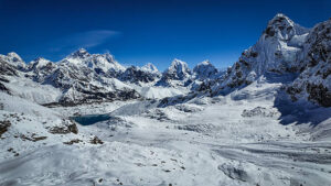
The Everest Base Camp Trek Route runs about 60 to 65 km from Lukla (2,860 m) up the Dudh Koshi and Khumbu valleys, via Phakding, Namche Bazaar, Tengboche, Dingboche, Lobuche and Gorakshep, to base camp at 5,364 m. Most trekkers take eight days up, including two acclimatisation days, and three days back down via Pheriche.
The full round trip is roughly 130 km on foot, usually completed in 12 days of walking within a 14-day trip from Kathmandu. Most stages take four to seven hours, and the trail is a well-used footpath, with no roads and no technical climbing.
Everest Base Camp Trek Route at a Glance
- Start and finish: Lukla, reached by a short mountain flight from Kathmandu or Ramechhap.
- Distance: About 60 to 65 km one way and roughly 130 km round trip.
- Highest points: Everest Base Camp (5,364 m) and Kala Patthar (5,545 m).
- Main stops: Phakding, Namche Bazaar, Tengboche, Dingboche, Lobuche and Gorakshep.
- Acclimatisation stops: Namche Bazaar and Dingboche.
- Return: Down the same valley, with a night in Pheriche instead of Dingboche.
- Rivers followed: The Dudh Koshi to Namche, the Imja Khola to Dingboche and the Khumbu Khola and Khumbu Glacier to base camp.
- Checkpoints: As you leave Lukla and at the Monjo park entrance.
- Terrain: Stone paths, steps, suspension bridges, hillside trails and, at the top, rocky glacier moraine.
- Best seasons: Spring (March to May) and autumn (late September to November).
- Our trek: The Everest Base Camp Trek, led by licensed Sherpa guides.
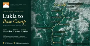
The Everest Base Camp Trek route, stage by stage: Lukla to Phakding, Namche Bazaar, Tengboche, Dingboche, Lobuche, Gorakshep and base camp, returning via Pheriche.
How the Route Works: Valleys, Rivers and the Shape of the Trail
The easiest way to understand the Everest Base Camp Trek Route is to follow the water. From Lukla, the trail heads north up the deep, forested gorge of the Dudh Koshi to Namche Bazaar, the Sherpa capital. Beyond Namche, it contours east along the hillside high above the river, drops to the water at Phunki Tenga and climbs to the monastery at Tengboche.
From Tengboche, the route enters the valley of the Imja Khola, which flows down from Island Peak and Lhotse, and climbs to Dingboche. It then turns northwest into the Khumbu Khola valley. This river flows from the Khumbu Glacier and follows the glacier’s moraine past Lobuche and Gorakshep to base camp at the foot of the Khumbu Icefall. Almost everything you see, from the first pine forests to the last ice, lies within the Sagarmatha National Park.
A Day on the Route
Every day on the Everest Base Camp Trek Route follows a similar rhythm. You wake to tea around six, pack your bag for the porters, eat a hearty breakfast and start walking by seven or eight, when the air is clear and the mountains are at their best. Lunch is taken at a teahouse along the way, and most stages end in the early afternoon, leaving time to rest, wash, explore the village or take a short acclimatisation walk. Dinner is served early around the warm stove in the dining room, and by eight most trekkers are asleep. On our Everest Base Camp Trek, your guide briefs you on the next stage every evening, so you always know what tomorrow brings.
Stage One: Lukla to Phakding
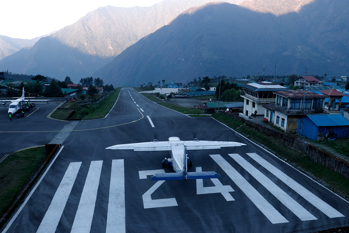
From the airstrip at Lukla, at 2,860 m, the trail leaves the end of the village street through a gateway and descends gently towards the river. At Chheplung, the trail from Jiri and the lower Solu hills joins from the south, and the path continues past mani walls, chortens and carved prayer stones through small villages and fields of potatoes and barley.
You cross the Thado Koshi on a suspension bridge, pass the prayer wheels at Ghat and reach Phakding, at 2,610 m, spread along both banks of the Dudh Koshi. This first stage is mostly downhill, about 8 km and three to four hours, and is designed as a gentle start after the flight. Our guide to Phakding and Monjo describes the villages in detail.
Stage Two: Phakding to Namche Bazaar
The second stage is longer, about 12 km and five to six hours, and ends with the first big climb. From Phakding, the trail follows the river north through Toktok and Benkar, where waterfalls tumble from the cliffs, to Monjo, at about 2,835 m, where the Sagarmatha National Park entrance gate checks your permits. Just beyond, Jorsalle is the last village before the climb.
Past Jorsalle, the path reaches the confluence of the Dudh Koshi and the Bhote Koshi and crosses the high Hillary Suspension Bridge, draped in prayer flags far above the river. Then comes the long zigzag climb of about 700 m through pine forest to Namche Bazaar, at 3,440 m. Partway up, on a clear day, a gap in the trees gives your first view of Everest’s summit, a tiny dark pyramid far to the north-east.
Acclimatisation Day in Namche Bazaar
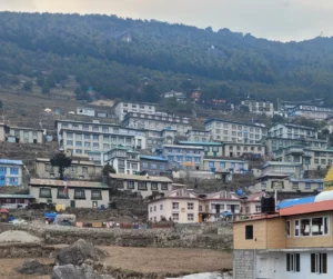
Namche sits in a horseshoe-shaped bowl on the hillside, its lodges, bakeries, gear shops and monasteries stacked in terraces above a weekly market. The route builds in a full day here to help your body adjust. The classic hike climbs to Syangboche and the Hotel Everest View, at about 3,880 m, for a panorama of Everest, Lhotse and Ama Dablam, and continues to the villages of Khumjung and Khunde before you return to sleep in Namche.
On the ridge above the village, the national park visitor centre and a small Sherpa museum explain the history and culture of the Khumbu, described in our guide to Sherpa culture and traditions.
Stage Three: Namche Bazaar to Tengboche
This is one of the most beautiful stages of the Everest Base Camp Trek Route, about 10 to 11 km and five to six hours. From Namche, the trail contours around the hillside, high above the Dudh Koshi, to Kyangjuma and Sanasa, with Ama Dablam, Thamserku and Kangtega filling the view. At Sanasa, a trail branches north towards Mong La and the Gokyo valley; the Everest Base Camp route continues ahead and descends steeply to the river.
At Phunki Tenga, at about 3,250 m, water-driven prayer wheels turn beside the bridge. From here, the trail climbs about 600 m through rhododendron, fir and birch forest to Tengboche, at 3,860 m, where the largest monastery in the Khumbu stands on a ridge facing Everest and Ama Dablam. If you can, visit the afternoon prayers, and read our guide to Tengboche Monastery and the Mani Rimdu festival.
Stage Four: Tengboche to Dingboche
About 11 km and five to six hours, this stage leaves the forest behind. The trail descends through rhododendrons to Deboche, at about 3,820 m, crosses the Imja Khola on a suspension bridge and climbs to Pangboche, at about 3,985 m, home to what is said to be the oldest monastery in the Khumbu.
Beyond Pangboche, the trees disappear, and the valley opens into yak pastures and stone huts around Somare and Orsho. Shortly after, the trail splits: the left branch follows the Khumbu Khola to Pheriche, and the right branch crosses the river and climbs into the Imja valley to Dingboche, at 4,410 m, a village of stone-walled fields with views of Ama Dablam, Lhotse and Island Peak.
Acclimatisation Day in Dingboche
Dingboche is the second rest stop on the route. The classic hike climbs the ridge of Nangkartshang behind the village, reaching above 5,000 m for the first time, with views of Lhotse, the Imja valley and Makalu, one of Nepal’s eight-thousand-metre peaks, before you return to sleep in Dingboche. Another option is a gentle walk up the valley towards Chhukung, at about 4,730 m, described in our guide to Chhukung Ri and the Chhukung valley. Our guide to altitude sickness on the Everest Base Camp trek explains why these rest days matter.
Stage Five: Dingboche to Lobuche
About 8 to 9 km and four to five hours, this stage takes you above 4,900 m. The trail climbs behind Dingboche onto the open ridge above Pheriche and contours across wide, windswept pastures to Thukla, also called Dughla, at about 4,620 m, a cluster of lodges at the foot of the Khumbu Glacier’s terminal moraine.
From Thukla, the trail crosses the glacier stream and climbs steeply up the moraine to a windswept ridge covered with memorial chortens and prayer flags, built for climbers and Sherpas who lost their lives on Everest. It is one of the most moving places on the route. Beyond the memorials, the path climbs gently up the valley beside the glacier to Lobuche (4,910 m).
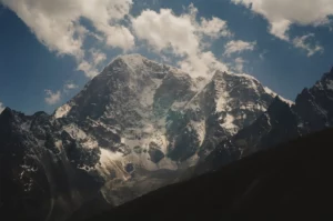
Stage Six: Lobuche to Gorakshep and Everest Base Camp
The big day of the Everest Base Camp Trek Route covers about 12 km and takes seven to eight hours. From Lobuche, the trail follows the lateral moraine of the Khumbu Glacier, passing the turn-off to the Italian-built Pyramid research station, and crosses a jumble of rocky moraine below the Changri glaciers to Gorakshep, at 5,164 m, the last lodges on the route, beside a sandy, often frozen lakebed below Kala Patthar.
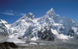
After lunch, the trail to base camp continues along the moraine and onto the rocky edge of the glacier, with Nuptse towering above and Pumori behind you. Everest Base Camp, at 5,364 m, lies on the Khumbu Glacier at the foot of the Khumbu Icefall. In spring, it fills with the colourful tents of climbing expeditions; in autumn, it is quieter, marked by prayer flags and painted rocks. You return to sleep at Gorakshep. Our guide to Everest Base Camp describes the scene.
Kala Patthar: The Best View on the Route
Base camp itself has no view of Everest’s summit, which is hidden behind the West Shoulder and Nuptse. For the classic view, you climb Kala Patthar, the dark hill above Gorakshep, at 5,545 m, the route’s highest point. Most trekkers start in the dark to reach the top for sunrise; it’s a climb of about 400 m and takes about 1.5 to 2 hours, and you watch the sun rise over Everest, Nuptse, and Changtse, with Pumori towering behind you. Our comparison of Gokyo Ri vs Kala Patthar explains how it compares with the region’s other great viewpoint.
The Return Route: Base Camp to Lukla
Coming down is much faster. After Kala Patthar and breakfast at Gorakshep, the route descends past Lobuche and Thukla and, instead of returning to Dingboche, follows the Khumbu Khola down to Pheriche (4,240 m), a long day of about 15 to 17 km. Pheriche is home to the Himalayan Rescue Association aid post, which treats trekkers with altitude sickness in the main seasons.
The next day, you descend about 18 to 20 km to Namche, passing Pangboche and Tengboche or the lower trail beside the river, and on the final day you walk another 18 to 20 km back to Lukla, retracing the first two stages. Many trekkers find these long descents hard on the knees, so trekking poles help a lot. If your legs would rather fly, see our guide to the Everest Base Camp Trek with helicopter return.
Culture Along the Route
The Everest Base Camp Trek Route is also a pilgrimage through Sherpa Buddhist culture. You pass carved mani stones, prayer wheels turned by hand and by water, painted chortens and gateways, and the monasteries of Tengboche and Pangboche, where monks chant at dawn and dusk. Many Sherpa families trace their faith to Guru Rinpoche, the great teacher described in our article on Guru Padmasambhava and Maratika, and the Mani Rimdu festival at Tengboche is a highlight of the autumn calendar. As you walk clockwise, you will pass mani walls and chortens on your right, and you can accept a cup of butter tea if a family offers one.
Wildlife Along the Route
The route’s lower forests and cliffs are rich in wildlife. Himalayan thar graze the cliffs around Namche and Kyangjuma, the danphe, Nepal’s dazzling national bird, flashes through the forests near Tengboche and Pangboche, and shy musk deer live in the woods below the monastery. Lammergeiers and Himalayan griffons soar above the valleys, and yaks and their hybrids carry loads all the way to Gorakshep; if wildlife is a passion, round off your trip with our Chitwan Jungle Safari in the lowlands.
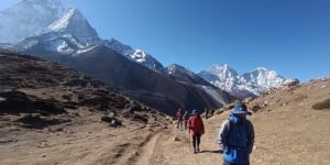
Route Distances and Walking Times
Distances on mountain trails are approximate, but on the standard route they look like this:
- Lukla to Phakding: About 8 km; three to four hours.
- Phakding to Namche Bazaar: About 12 km; five to six hours.
- Namche acclimatisation hike: About 5 to 7 km round trip; three to five hours.
- Namche to Tengboche: About 10 to 11 km; five to six hours.
- Tengboche to Dingboche: About 11 km; five to six hours.
- Dingboche acclimatisation hike: About 4 to 5 km round trip; three to four hours.
- Dingboche to Lobuche: About 8-9 km; four to five hours.
- Lobuche to base camp and back to Gorakshep: About 12 km; seven to eight hours.
- Kala Patthar and down to Pheriche: About 15-17 km; seven to eight hours.
- Pheriche to Namche Bazaar: About 18 to 20 km; six to seven hours.
- Namche Bazaar to Lukla: About 18 to 20 km; six to seven hours.
Altogether, that is roughly 130 km on foot. Our guide to how many days the EBC trek takes explains why the walk spans two weeks.
The Altitude Profile of the Route
The route gains altitude in steps, and the sleeping altitudes are what matter most for acclimatisation:
- Night 1, Phakding (2,610 m): A little lower than Lukla, a gentle start.
- Nights 2 and 3, Namche Bazaar (3,440 m): The first big gain, followed by a rest day.
- Night 4, Tengboche (3,860 m): A moderate gain.
- Nights 5 and 6, Dingboche (4,410 m): The second big gain, followed by a rest day.
- Night 7, Lobuche (4,910 m): Into thin air.
- Night 8, Gorakshep (5,164 m): The highest night of the trek.
This pattern, with no more than about 500 m of sleeping gain on most days and a rest day roughly every 1,000 m, is what makes the classic route safe for fit beginners. Read our acute mountain sickness page and see our guide to Everest Base Camp Trek difficulty to understand how the altitude feels at each stage.
Checkpoints and Permits Along the Route
Two permits cover the whole Everest Base Camp Trek Route from Lukla: the Khumbu Pasang Lhamu Rural Municipality permit, checked as you leave Lukla, and the Sagarmatha National Park entry permit, checked at the park gate at Monjo. Further checks can take place along the trail, so keep both permits handy with your passport. Our guide to Everest Base Camp Trek permits explains each one, and our article on the Everest Base Camp Trek without a guide covers the rules on guides.
Junctions and Route Choices Along the Way
- Chheplung: The trail from Jiri, Salleri and the lower Solu hills joins the main route.
- Namche Bazaar: Trails lead west to Thame and the Renjo La, north to Khumjung and east to Tengboche.
- Sanasa: The Gokyo trail branches north towards Mong La and Phortse.
- Pangboche: An upper trail runs past the old monastery, above the main path.
- Below Pheriche and Dingboche: The main split between the Khumbu Khola and Imja valleys.
- Dingboche: The trail east to Chhukung, Island Peak and the Kongma La.
- Thukla and Lobuche: Side trails lead west towards Dzongla and the Cho La, and east towards the Kongma La.
- Gorakshep: The path divides for Kala Patthar and base camp.
These junctions are well used, but in cloud or snow it is easy to take the wrong one, which is one reason our guides walk with every group.
Alternative Routes to Everest Base Camp
The Khumjung High Route
From Namche, many groups take the higher trail via Khumjung and rejoin the main route near Kyangjuma, adding culture and views to the acclimatisation day.
The Phortse Route
A quieter trail crosses Mong La and descends to the village of Phortse, then rejoins the main route near Pangboche, with fewer trekkers and fine views of Ama Dablam.
Via Pheriche on the Way Up
Some itineraries sleep in Pheriche instead of Dingboche on the way up, then follow the same path to Thukla and Lobuche.
Gokyo, the Cho La and the Three Passes
Strong trekkers can combine the base camp route with the turquoise lakes of Gokyo on the Gokyo Lakes Trek, crossing Cho La, or tackle all three high passes, including Renjo La, on the Everest 3 Pass Trek. See our Gokyo Lakes Trek guide and Everest Three Passes Trek guide.
Walking In From Jiri or the Road Head
Before the Lukla airstrip was built, expeditions walked in from the lower hills, and you still can on the Jiri to Everest Trek, described in our Jiri to Everest Base Camp guide, or by driving to a road head in the Solu hills on the Everest Base Camp Trek by Road. Both join the classic route at Chheplung, below Lukla.
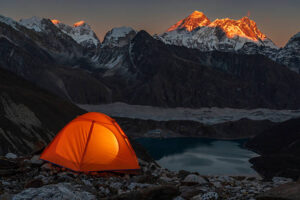
The Other Side of Everest
Everest also has a base camp on its northern, Tibetan side, reached by road rather than on foot, described in our Lhasa to Everest Base Camp guide and visited on the Lhasa to Everest Base Camp Overland Tour.
Terrain, Trail Conditions and Hazards by Section
- Lukla to Namche: Stone paths, steps and long suspension bridges, with yak and zopkio caravans; landslides can affect the trail in the monsoon.
- Namche to Tengboche: An airy hillside path with steep drops, then a steep forest climb.
- Tengboche to Dingboche: Open, windy valleys and the first truly cold nights.
- Dingboche to Lobuche: A steep, rocky climb above Thukla, often in wind and cloud.
- Lobuche to base camp: Rough moraine, loose rock and ice, where the path shifts from season to season.
- Kala Patthar: A steep, sandy and rocky climb, usually in the dark and bitter cold.
Always give way to animals on the mountainside of the trail, start early to avoid afternoon cloud, and take extra care on the long descents. Helicopters can land at most villages on the route in an emergency, in daylight and good weather, as our guide to helicopter rescue in the Everest region explains.
Lodges, Food and Facilities Along the Route
Teahouse lodges line the entire route. Between Lukla and Namche, lodges are plentiful and comfortable, many with hot showers and Wi-Fi, and Namche has bakeries, cafes, gear shops and pharmacies. Higher up, lodges in Tengboche, Dingboche and Pheriche are simpler but welcoming, while Lobuche and Gorakshep have only a few basic lodges that fill quickly in the busy seasons. Basic medical help is available in Lukla, Namche, at the hospital in Khunde and, in season, at the Pheriche aid post.
Dal bhat, noodle soup, potatoes and Tibetan bread are the staples all the way up. For extra comfort lower down, our guide to the luxury lodges in the Everest region describes the best options between Lukla and Namche.
Best Time to Walk the Route
The route is busiest and most reliable in spring and autumn. Autumn, from late September to November, brings the clearest skies, described in our guide to the Everest Base Camp Trek in October. Spring, from March to May, brings blooming rhododendrons below Tengboche and the expedition season at base camp, covered in our guide to the Everest Base Camp Trek in April. Winter is cold but clear, and the monsoon brings cloud and rain to the lower valley, as our guide to the Everest Base Camp Trek in monsoon explains. Our month-by-month guide to the best time for the Everest Base Camp trek has the details.
How Long Does the Route Take?
The classic route takes 12 days of walking, which fits within a 14-day trip from Kathmandu, as in our 14-day Everest Base Camp Trek guide. Shorter versions remove a rest day or return by helicopter, as described in our guide to the short Everest Base Camp Trek in 10 days, while longer ones add extra acclimatisation or side trips. Whatever the length, never skip the acclimatisation days in Namche and Dingboche.
Who Is the Route For?
The route suits fit walkers of many ages, including first-timers, as our guides to the Everest Base Camp Trek for beginners, the Everest Base Camp Trek over 50 and the Everest Base Camp Trek with kids explain. Prepare with our Everest Base Camp Trek training plan, and pack with our Everest Base Camp Trek packing list and trekking equipment page.
Walking the Route in Comfort
You can walk the same route with more comfort. The Everest Base Camp Luxury Lodge Trek uses the best lodges in each village, described in our Luxury Everest Base Camp Trek guide, and the Luxury Everest Base Camp Trek with Helicopter Return saves the long walk down. The Everest Base Camp Helicopter Trek and the Everest Elite Luxury Heli Trek combine walking and flying; compare them in our article on the EBC helicopter tour vs heli trek. The Everest Base Camp Yoga Trek, described in our Everest Base Camp yoga trek guide, adds daily yoga to the journey.
Seeing the Route From the Air
If walking the whole route isn’t for you, a helicopter can fly it in the morning. The Everest Helicopter Tour and the Mt Everest by Helicopter Tour, described in our guide to the Everest helicopter tour with breakfast, follow the valley to Kala Patthar, as does the Sharing Everest Helicopter Tour with Kala Patthar Landing, explained in our Kala Patthar landing guide. Our articles on the Everest Base Camp helicopter tour, whether a helicopter can land at Everest Base Camp, the best seasons for an Everest helicopter tour and Everest helicopter tour restrictions help you plan, and our comparison of the EBC trek or a helicopter tour weighs the two. For the simplest view, see our Everest mountain flight guide.
Photography Spots Along the Route
- The Hillary Suspension Bridge: Prayer flags against the gorge, best from the trail just before it.
- The first Everest view: On the climb to Namche, on a clear morning.
- Namche at dusk: Lights coming on around the village horseshoe.
- Kyangjuma: One of the finest views of Ama Dablam on the route.
- Tengboche Monastery: With Everest and Lhotse rising behind it.
- Dingboche’s stone-walled fields: With Ama Dablam and Island Peak above.
- The Thukla memorials: Prayer flags and chortens against the peaks.
- Base camp and the Khumbu Icefall: The blue ice towers at the foot of Everest.
- Kala Patthar at sunrise: The classic Everest photo.
Tips for Following the Route
- Start early: Mornings are clearer, and you reach your lodge before the afternoon cloud.
- Walk slowly uphill: Especially on the climbs to Namche, Tengboche and Thukla.
- Learn the junctions: Sanasa, the Pheriche and Dingboche split, and Gorakshep are the key ones.
- Use the rest days well: Climb high, then sleep low.
- Carry water and snacks: Lodges are frequent below Lobuche but sparse above.
- Pass mani walls and chortens on your right: Walk clockwise, as local custom asks.
- Build in spare days: For weather at Lukla, see our guide to Lukla flights, and consider our Ramechhap airport transfer when flights leave from Ramechhap.
Common Route Mistakes
- Rushing the Namche climb: The first big gain often brings the first headache.
- Skipping a rest day: The route’s acclimatisation stops are there for a reason.
- Taking the wrong turn at Sanasa: The Gokyo trail branches north here.
- Walking late above Lobuche: Cloud and cold arrive quickly in the afternoon.
- Expecting a summit view at base camp: Climb Kala Patthar for the classic Everest view.
- Underestimating the descent: Long days on tired knees can lead to slips and falls.
Beyond the Classic Route
Once you reach base camp, the Khumbu has much more to offer. Ama Dablam Base Camp Trekking, described in our Ama Dablam Base Camp Trek guide, is a quieter side trip from Pangboche, and the Everest View Trek, described in our guide to the Luxury Everest View Trek, walks the first stages of the route in a few days. Climbers can use the route to reach Island Peak Climbing, explained in our Island Peak climbing guide, and Lobuche Peak Climbing, described in our guide to Lobuche East Peak Climbing, while Mera Peak Climbing, covered in our Mera Peak guide, starts from Lukla but heads east into the Hinku valley. Each spring, runners race down part of this very route on the Everest Marathon.
Other Classic Trekking Routes in Nepal
If you love the Everest route, Nepal has many more classic trails. The Annapurna Base Camp Trek, described in our ultimate guide to Annapurna Base Camp, climbs into a ring of giant peaks; the Annapurna Circuit Trek crosses the Thorong La; the Manaslu Circuit Trek circles the world’s eighth-highest mountain; and the Langtang Valley Trek is a shorter adventure close to Kathmandu. Our list of the 50 best treks in Nepal and our guide to trekking in Nepal help you choose.
Responsible Trekking on the Route
The route passes through the homeland of the Sherpa people and one of the Himalayas’ most sacred landscapes. Stay in local lodges, carry a refillable bottle instead of buying plastic, carry out your rubbish, respect monasteries and chortens, and ask before photographing people. Our overview of Buddhism in Tibet explains the faith behind the prayer flags, and our responsible tourism page explains how we care for the trail and the people who work on it.
Before and After the Route: Kathmandu and Beyond
The route begins and ends in Kathmandu, where a day of Kathmandu sightseeing or our guided Kathmandu Day Tour takes you to the great stupas of Boudhanath and Swayambhunath and the temples of Pashupatinath. After the trek, many trekkers relax in Pokhara, as described in our guide to Pokhara sightseeing, before flying home.
Frequently Asked Questions About the Everest Base Camp Trek Route
What is the route to Everest Base Camp from Lukla?
Lukla to Phakding, Namche Bazaar, Tengboche, Dingboche, Lobuche and Gorakshep, then on to base camp, with rest days in Namche and Dingboche and a return via Pheriche.
How far is it from Lukla to Everest Base Camp?
About 60 to 65 km one way, or roughly 130 km for the round trip on foot.
How many days does the route take?
Usually eight days up, including two acclimatisation days, and three or four days down, within a 14-day trip from Kathmandu.
Which villages do you pass on the way?
Chheplung, Ghat, Phakding, Benkar, Monjo, Jorsalle, Namche Bazaar, Kyangjuma, Phunki Tenga, Tengboche, Deboche, Pangboche, Somare, Dingboche, Thukla, Lobuche and Gorakshep.
Where do you acclimatize on the route?
In Namche Bazaar, with a hike to the Hotel Everest View or Khumjung, and in Dingboche, with a hike up Nangkartshang or towards Chhukung.
What is the hardest part of the route?
The climb from Thukla to Lobuche and the long day from Lobuche to base camp and back to Gorakshep, both above 4,600 m.
Is the return route the same as the way up?
Mostly, but most itineraries descend via Pheriche instead of Dingboche and walk back to Lukla in three or four days.
Where does the Gokyo route split from the base camp route?
At Sanasa, just beyond Namche, where the Gokyo trail branches north towards Mong La.
Can you start the route without flying to Lukla?
Yes. You can walk in from Jiri or drive to a road head in the Solu hills; both trails join the classic route at Chheplung.
Which trek follows this route?
Our Everest Base Camp Trek follows the classic route in 14 days with licensed Sherpa guides.
Final Thoughts: Follow the River to Everest
The Everest Base Camp Trek Route is a journey through a whole world: from the green gorge of the Dudh Koshi to the bustling terraces of Namche, the monastery at Tengboche, the stone-walled fields of Dingboche and finally the ice and rock of the Khumbu Glacier. Knowing how the route fits together, where it climbs, where it splits and why it rests, makes every step more meaningful.
Walk it with us on our Everest Base Camp Trek, or in comfort on the Everest Base Camp Luxury Lodge Trek. Meet our team, learn more about our trekking company in Nepal, check our Nepal visa information and legal documents, then plan your trip or contact us today.
Quick Inquiry
Explore More


