Renjo La Pass: The Most Scenic Pass in the Everest Region
Renjo La Pass: The Most Scenic Pass in the Everest Region
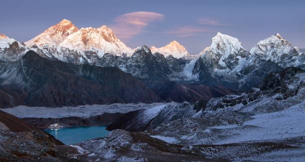
The last few stone steps are the hardest. Your breath comes short, the prayer flags crack in the wind above you, and then the ground stops rising. You turn around, and the whole of the Khumbu lies at your feet: the turquoise sweep of the Gokyo Lake, the grey river of the Ngozumpa Glacier and, rising above every other summit, the dark pyramid of Everest with Lhotse and Makalu at its side. Few trekkers ever forget their first look from the top of Renjo La.
The Renjo La Pass is the westernmost of the three high passes of the Everest region, a windswept saddle at about 5,360 m that links the Gokyo Lakes with the remote Bhote Koshi valley and the historic Sherpa village of Thame.
It is the lowest and least technical of the three passes crossed on our Everest 3 Pass Trek, with no glacier to cross, yet many trekkers and guides call it the most scenic. No other viewpoint in the Khumbu lines up Everest, a turquoise lake and a great glacier in a single view quite like it.
In this guide, our Sherpa team explains everything you need to know about Renjo La: where it is, what you see from the top, how high it really is, the crossing day hour by hour, which direction to walk, how difficult it is, how to acclimatise, the best seasons, the lodges at Lungden and Thame, safety, permits and photography, and how the pass fits into the wider Everest Three Passes Trek circuit.
The Short Answer: What Is Renjo La Pass?
Renjo La Pass (about 5,360 m) is the westernmost of the Everest region’s three high passes, linking Gokyo with Lungden and the Thame valley. The lowest and least technical of the three, with no glacier, it offers what many call the finest view in the Khumbu: Everest, Lhotse and Makalu above the turquoise Gokyo Lake. Crossing takes six to eight hours.
It is best crossed from east to west, from Gokyo to Lungden, in autumn or spring, with a pre-dawn start, good acclimatisation and an experienced guide.
Renjo La Pass at a Glance
- Altitude: About 5,360 m (17,585 ft), the lowest of the three high passes; some maps and GPS devices show slightly higher figures.
- Location: On the ridge between the Gokyo Valley and the Bhote Koshi Valley, inside Sagarmatha National Park.
- Connects: Gokyo (about 4,790 m) with Lungden (about 4,380 m), then Thame and Namche Bazaar.
- Height gain and loss: About 570 m up from Gokyo, then almost 1,000 m down to Lungden.
- Crossing time: Usually six to eight hours from Gokyo to Lungden.
- Distance: Roughly 12 to 13 km between Gokyo and Lungden on most GPS tracks.
- Terrain: A clear trail over moraine and scree, with stone steps on the steepest sections and no glacier.
- Difficulty: Strenuous because of the altitude and the long descent, but not technical in normal conditions.
- Best seasons: Autumn (late September to November) and spring (March to May).
- Facilities: No teahouses on the pass; lodges in Gokyo, Lungden, Marlung and Thame.
- On our trek: The third and final pass of our Everest 3 Pass Trek, crossed on Day 16.
Where Is Renjo La?
Renjo La crosses the high ridge that separates two of the Khumbu’s great valleys. To the east lies the Gokyo valley, shaped by the Ngozumpa Glacier and dotted with sacred lakes.
To the west lies the valley of the Bhote Koshi, a river from Tibet that flows down from the Nangpa La on the Tibetan border, past Lungden, Marlung and Thame, to meet the Dudh Koshi below Namche Bazaar. The whole area lies inside the national park, the UNESCO World Heritage Site that protects the Everest region.
Of the three high passes, Renjo La is the furthest west. Kongma La, in the east, links Chhukung with Lobuche; Cho La, in the middle, links Dzongla with Thangnak and Gokyo; and Renjo La completes the circle by leading from Gokyo into the Thame valley. Crossed together, they form one of the finest trekking circuits in the Himalaya.
Renjo La, Renjola or Ranjo La? The Name Explained
You will see the pass spelt in many ways: Renjo La, Renjo-La, Renjola, Ranjo La or simply Renjo Pass. In the Sherpa and Tibetan languages, la means pass, so “Renjo La Pass” literally means “Renjo Pass Pass”, but the double name has become how most trekkers search for it.
The same word appears all over the Himalaya: Kongma La, Cho La, and Nangpa La in the Khumbu; Thorong La on the Annapurna Circuit Trek; Larkya La, better known as the Larke Pass, on the Manaslu Circuit Trek; and Dolma La Pass on the Kailash kora in Tibet.
Why Renjo La Is Called the Most Scenic Pass in the Everest Region
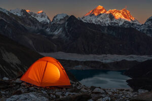
Every pass in the Khumbu offers superb views. What makes the Renjo La Pass special is its composition. Because the pass sits west of Gokyo and looks east, all the elements of the classic Everest panorama stack up in front of you: lake, village, glacier and the highest mountains on Earth.
The View East: Everest Above the Gokyo Lake
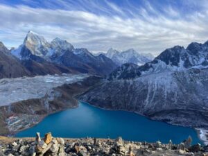
Directly below lies Dudh Pokhari, the third of the Gokyo Lakes, with the stone lodges of Gokyo village on its far shore. Beyond the village, the rubble-covered Ngozumpa Glacier, often described as the longest in Nepal, runs south like a frozen river.
Above it all rise Everest, Nuptse and Lhotse, with Makalu further to the right and the sharp, closer summits of Cholatse and Taboche framing the scene. On a clear morning, Pumori and Changtse, Everest’s northern neighbour in Tibet, appear too. Our guide to Gokyo Ri and the Fifth Lake describes the lakes in more detail.
Four of the World’s Six Highest Mountains
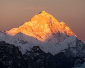
On a clear day, the panorama from Renjo La includes Everest (8,849 m), Lhotse (8,516 m), Makalu (8,485 m) and, to the north, Cho Oyu (8,188 m). These are the first, fourth, fifth and sixth highest mountains on Earth, all visible from one trail. Few places on any trekking route show so many eight-thousanders at once; learn more about these giants in our article on Nepal’s eight-thousand-metre peaks.
The View West: The Wild Bhote Koshi Valley
Turn around, and the mood changes completely. To the west, the pass drops steeply towards small glacial lakes and the wide, empty uplands of the upper Bhote Koshi, ringed by snow peaks along the Tibetan border. There are no lodges in sight, only moraine, yak pastures and sky. Many trekkers say this side of the pass feels more like Tibet than Nepal, and after the busy trails of the Everest Base Camp Trek, the silence is unforgettable.
Renjo La vs Gokyo Ri: Which View Is Better?
Gokyo Ri, at about 5,357 m, and Renjo La, at about 5,360 m, are almost the same height and face each other across the Gokyo Lake. Both offer world-class views of Everest, so which is better?
- Gokyo Ri: A round-trip climb of two to three hours from Gokyo, usually made for sunrise or late-afternoon light. You look down on the lake and straight across the Ngozumpa Glacier to Everest, with Cho Oyu filling the northern skyline.
- Renjo La: A one-way crossing, usually reached in mid-morning. You look across the lake toward Everest, so the lake, village, glacier, and mountains line up in one frame, and the wild western valley adds a second panorama behind you.
Most trekkers who have stood on both say the views are equally magnificent but different, and the good news is that our itinerary includes both. Our comparison of Gokyo Ri vs Kala Patthar explains how Gokyo’s famous summit compares with Kala Patthar above Everest Base Camp.
How High Is Renjo La? Altitude Explained
The most widely used altitude for the Renjo La Pass is 5,360 m, or 17,585 ft. You will also see higher figures, sometimes above 5,400 m, on certain maps, GPS devices and photo captions.
The differences come from survey methods, GPS accuracy and exactly which point on the broad saddle was measured. For planning, most guides and maps use 5,360 m, which puts Renjo La at almost exactly the height of Everest Base Camp, at 5,364 m.
At this altitude, the air pressure is roughly half that at sea level, so every breath carries about half as much oxygen. From Gokyo, at about 4,790 m, you gain roughly 570 m to the pass and then descend almost 1,000 m to Lungden, at about 4,380 m. From the Lungden side, the climb is nearly 1,000 m. Understanding Acute Mountain Sickness and how to prevent it is essential before any crossing.
Renjo La Route Profile
Here is the full route over the Renjo La Pass from Gokyo to Namche Bazaar, with approximate altitudes and walking times:
- Gokyo (about 4,790 m): The lakeside village where the crossing begins.
- Renjo La (about 5,360 m): Three to four hours of climbing from Gokyo.
- Lungden (about 4,380 m): Two to three hours of descent from the pass.
- Marlung (about 4,210 m): A short walk down the Bhote Koshi valley from Lungden.
- Thame (about 3,800 m): Four to five hours from Lungden in total.
- Namche Bazaar (about 3,440 m): Three to four hours from Thame.
Renjo La vs Cho La vs Kongma La: The Three Passes Compared
Each of the three high passes has its own character. Here is how they compare:
- Kongma La (about 5,535 m): The highest and easternmost, linking Chhukung and Lobuche. It is long, steep and rocky, followed by a tiring crossing of the Khumbu Glacier, and it is often the hardest day of the circuit. Our guide to Chhukung Ri and the Chhukung valley covers its approach.
- Cho La (about 5,420 m): The middle pass and the most technical, with a small glacier on the summit that is often icy, between Dzongla and Thangnak. Our Cho La Pass crossing guide explains every section.
- Renjo La (about 5,360 m): The lowest and westernmost, with no glacier, a well-made trail with stone steps on its steepest sections, the fewest trekkers and, for many, the best view.
In short, Kongma La is usually the toughest, Cho La the most technical and Renjo La the most rewarding for the effort. That does not make it easy: any day above 5,000 m is serious, and conditions can change quickly.
Which Direction Should You Cross Renjo La?
You can cross Renjo La in both directions, and the choice matters more than many trekkers expect.
East to West: From Gokyo to Lungden (Our Recommendation)
Crossing from Gokyo means starting at about 4,790 m after one or more nights at the lakes, so you are already well acclimatised. The climb is shorter, about 570 m, and gentle at first, while the steepest ground comes on the descent. You also save the most beautiful view for the end of your adventure and finish with a peaceful walk down the Thame valley. This is the direction we use on our itinerary.
West to East: From Lungden to Gokyo
Coming from Thame, you climb nearly 1,000 m from Lungden to the pass, usually earlier in your trip, when your body has had less time to adapt. The reward is that Everest appears as you crest the pass, and you descend to the comfortable lodges of Gokyo. This direction suits trekkers who build in extra nights in Thame and Lungden, and it is used on the clockwise three passes route and some Gokyo loops.
For the full circuit, crossing Kongma La first and Renjo La last gives the best acclimatisation, as explained in our Everest Three Passes Trek route guide.
Crossing Renjo La From Gokyo: The Day Step by Step
Before Dawn in Gokyo
The day begins in darkness. After hot drinks and a filling breakfast, you fill insulated bottles, pack a lunch and set off by headlamp or first light, ideally around six in the morning. An early start brings calmer winds, firmer ground, clearer skies, and plenty of daylight for the long descent.
Along the Shore of Dudh Pokhari
The trail first heads towards the foot of Gokyo Ri, then turns west and follows the shore of Dudh Pokhari, with the water often frozen at the edges in late autumn. Soon it leaves the lake and begins to climb the slope above it.
The Climb and the Stone Steps
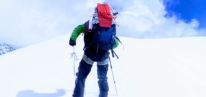
The first part of the ascent climbs steadily over grassy slopes and moraine, then becomes steeper with switchbacks. A gentler stretch across a high shelf lets you catch your breath before the final, steeper climb to the pass. On the steepest sections, stone steps laid by local communities make the trail far easier than it once was, but they can be slick with ice in the early morning, so take your time. Every time you stop, turn around: the view behind you grows with every step.
On Top of Renjo La
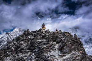
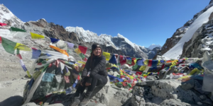
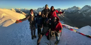
The summit is a narrow, rocky saddle draped with prayer flags and marked by stone cairns. It is usually cold and windy, so pull on your warm layers before you stop. Spend twenty to thirty minutes taking in the view, eating a snack and drinking, then start down while you still have energy. Most trekkers reach the top three to four hours after leaving Gokyo.
The Descent Past Angladumba Tsho and Relama Tsho
The western side is steeper. The trail drops quickly on steps and loose scree, then passes the small glacial lakes of Angladumba Tsho and Relama Tsho before easing onto sandy moraine and open yak pastures. Use your trekking poles, watch for ice in the shadows and keep a steady rhythm: a descent of almost 1,000 m is hard on the knees.
Arriving in Lungden
Two to three hours after leaving the pass, Lungden’s stone houses appear beside the Bhote Koshi. A hot meal, a pot of tea, and a warm stove await, and the rest of the afternoon is yours to rest, stretch, and enjoy the satisfaction of having crossed one of the great passes of the Khumbu.
A Sample Crossing-Day Timeline
- 5:00 am: Wake up for hot drinks and breakfast in Gokyo.
- Around 6:00 am: Leave by headlamp or first light.
- 6:00 to 7:00 am: Walk around the shore of Dudh Pokhari and begin the climb.
- 7:00 to 9:30 am: Climb steadily up the slope, then the switchbacks and stone steps to the pass.
- 9:30 to 10:30 am: Reach the top for photos, snacks and a rest.
- 10:30 am to 1:00 pm: Descend past the lakes onto the moraine and pastures.
- 1:00 to 2:00 pm: Arrive in Lungden for a late lunch.
These times are approximate and depend on your pace, the weather, and trail conditions. Your guide will adjust the plan on the day.
Beyond Lungden: Marlung, Thame and the Walk to Namche
Lungden, at about 4,380 m, is a tiny settlement of stone houses, yak enclosures and one or two simple lodges beneath a huge sky. From here, the trail follows the Bhote Koshi downstream through a wide, open valley, past Marlung, at about 4,210 m, small chortens, mani walls and the occasional yak caravan. The walk to Thame takes four to five hours and is mostly downhill, with the air growing thicker and the first junipers appearing as you descend.
From Thame, a beautiful trail leads through forests and small villages to Namche Bazaar in three to four hours, closing the loop. If you have a spare day in Namche, the short hike to the Hotel Everest View or the twin villages of Khumjung and Khunde is a lovely way to say goodbye to Everest. From Namche, the trail descends past Phakding to Lukla for your flight home.
Thame: Tenzing Norgay’s Village and Its Monastery
Thame, at about 3,800 m, is one of the most historic villages in the Khumbu. Tenzing Norgay, who reached the summit of Everest with Sir Edmund Hillary, spent his childhood here, and the village has produced several record-breaking Everest climbers since. The Himalayan Trust, founded by Hillary, helped build Thame’s school and clinic, and the village remains closely tied to Everest’s story.
Above the village, on a ridge at roughly 3,960 m, stands Thame Gompa, one of the oldest monasteries in the Khumbu and a centre of the Nyingma tradition of Tibetan Buddhism. It is a thirty- to forty-minute walk up from the village and well worth the effort.
Thame celebrates its own Mani Rimdu festival in spring, usually around May, with masked dances like those described in our guide to Tengboche Monastery and the Mani Rimdu festival. Learn more about daily life and beliefs in the valley in our guide to Sherpa culture and traditions.
Thame After the Flood
In recent years, a glacial lake outburst flood swept down the valley above Thame, destroying homes, several lodges, the school and the clinic. Thankfully, no lives were reported lost, and the community has been rebuilding with the support of organisations such as the Himalayan Trust.
It was not the first such disaster: decades earlier, the outburst of the Dig Tsho glacial lake destroyed a hydropower project being built near the village. Lodge capacity in Thame may still be more limited than before, so our team plans overnight stops carefully. Staying, eating and buying locally here directly supports the village’s recovery.
The Nangpa La and the Old Salt Trade
North of Lungden, the upper Bhote Koshi valley climbs toward Nangpa La, a glaciated pass at about 5,700 m on the border with Tibet. For centuries, it was the main trade route between the Khumbu and the Tibetan plateau.
Yak caravans carried grain and other goods north and returned with salt, wool and Tibetan wares, and the ancestors of the Sherpa people are believed to have come over this route from eastern Tibet centuries ago. The name Sherpa itself means “people from the east”.
Cross-border trade dwindled after the border closed in the mid-twentieth century, and today the Nangpa La is not part of any trekking route. Yet the Thame valley still feels deeply Tibetan in its houses, monasteries and customs. If Tibet calls you, our Lhasa Tibet Tour, the Kathmandu to Lhasa Tour and our Lhasa to Everest Base Camp guide show you the other side of the Himalaya, and our overview of Buddhism in Tibet explains the faith shared on both sides of the border.
Renjo La on Our Everest 3 Pass Trek
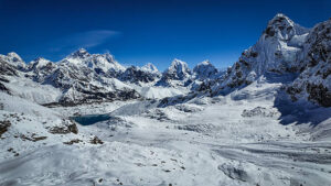
On our 21-day Everest 3 Pass Trek, Renjo La is the third and final pass. By the time you reach it, you have walked from Lukla via Namche, Tengboche, Pangboche, and Dingboche to Chhukung; climbed Chhukung Ri; crossed Kongma La; visited Everest Base Camp from Gorakshep; watched sunrise from Kala Patthar; and crossed Cho La to Gokyo. Here is how the final days unfold:
- Day 14: Cross Cho La to Gokyo: A long day over the glaciated pass, then across the Ngozumpa Glacier to the lakeside village.
- Day 15: Gokyo Ri and the lakes: A sunrise climb of Gokyo Ri and time to explore the lakeshore.
- Day 16: Cross Renjo La to Lungden: The trek’s most scenic pass, with a final, magnificent view of Everest.
- Day 17: Trek to Thame: Down the Bhote Koshi valley to Tenzing Norgay’s village.
- Day 18: Trek to Namche Bazaar: Through forests and villages, completing the great loop.
- Day 19: Trek to Lukla: Your last day on the trail, before the flight back to Kathmandu.
Our Everest Base Camp Trek itinerary describes the first part of the route in more detail, and our Ramechhap airport transportation service takes you to the Lukla flight from Manthali in the busy seasons, when most flights leave from there instead of Kathmandu.
Other Ways to Cross Renjo La
You do not have to walk all three passes to cross Renjo La. Popular alternatives include:
- The Gokyo and Renjo La loop: Walk up the Gokyo valley via Dole and Machhermo, enjoy the lakes, then cross Renjo La and return via Lungden and Thame. It takes around two weeks, and our team can tailor our Gokyo Lakes Trek to include the pass.
- Cho La and Renjo La: Reach Everest Base Camp on the classic route, cross Cho La to Gokyo and exit over Renjo La: two passes instead of three.
- The clockwise three passes: Start from Thame and cross Renjo La first, then Cho La and Kongma La, with extra acclimatisation nights early in the trip.
Whichever route you choose, our team can adapt the itinerary to your fitness, your time and the season.
Renjo La as a Day Hike From Gokyo
If your trek returns down the Gokyo valley, you can still enjoy the view from Renjo La. Fit, well-acclimatised trekkers can climb to the pass from Gokyo and return the same way in about five to seven hours, as an alternative to or addition to Gokyo Ri. It is a long day at high altitude, so go with your guide, start early and turn back if the weather changes. Other superb day walks from Gokyo include the fourth and fifth lakes and Scoundrel’s Viewpoint, and our Gokyo Lakes Trek guide covers the whole valley.
How Difficult Is Renjo La Pass?
Renjo La Pass is the easiest of the three high passes, but easy is relative above 5,000 m. Expect a strenuous day that tests your fitness, acclimatisation, and concentration on the descent.
The Altitude
The pass sits at about 5,360 m, where roughly half the oxygen is available compared with sea level. Every step uphill feels slow, and even fit trekkers stop often to breathe. The altitude, not the terrain, is the main challenge.
The Terrain
The trail is clear in good conditions, with moraine, scree and stone steps but no glacier and no climbing. Snow and ice can make the steps and the upper slopes slippery, and the steep western descent demands care.
The Length of the Day
Six to eight hours of walking, with almost 1,000 m of descent, is a long day at this altitude. The western side is remote, so you need the energy to keep going until you reach Lungden.
Who Can Cross Renjo La?
Renjo La suits fit trekkers with previous multi-day hiking experience and, ideally, a high-altitude trek behind them. You do not need climbing skills. If you are new to the Himalaya, start with our advice on the Everest Base Camp Trek for beginners; older trekkers will find useful tips in our guide to the Everest Base Camp Trek over 50; and our honest look at Everest Base Camp Trek difficulty explains what high-altitude trekking in the Khumbu really demands.
Acclimatisation Before Renjo La
Good acclimatisation is the key to a safe and enjoyable crossing. If you’re coming from Gokyo, you have usually spent at least one or two nights at the lakes and climbed Gokyo Ri; on the full three-pass circuit, your body has had more than two weeks to adapt. If you are coming from Thame, plan extra nights in Thame and Lungden before the climb.
- Know the symptoms: Headache, nausea, dizziness, loss of appetite, unusual fatigue and poor sleep.
- Tell your guide early: Our guides check every trekker’s health daily, including oxygen levels.
- Never go higher with worsening symptoms: Descending is the most effective treatment.
- Drink well and avoid alcohol: Both help your body adapt.
- Talk to your doctor before the trip: Ask about acclimatisation medication if you are considering it.
Read our guide to altitude sickness on the Everest Base Camp Trek before you go. The Himalayan Rescue Association runs an aid post at Pheriche on the Everest Base Camp side, and the hospital at Khunde serves the whole Khumbu. In an emergency, helicopters can reach Gokyo and Lungden in good weather, so make sure your travel insurance covers high-altitude trekking to the heights on your itinerary and helicopter rescue.
Best Time to Cross Renjo La Pass
Season matters on the Renjo La Pass, because snow and ice can make it dangerous or impassable.
Autumn (Late September to November)
The best season, with clear skies, stable weather and usually snow-free trails. October brings the clearest views and the busiest trails elsewhere in the Khumbu, though Renjo La itself stays relatively quiet. November is colder but crisp and clear. Our guide to the Everest Base Camp Trek in October describes the season.
Spring (March to May)
Also excellent, with longer, warmer days and rhododendrons blooming in the lower forests. Snow can linger on the pass in early spring, so April and May are usually best. See our guide to the Everest Base Camp Trek in April.
Winter (December to February)
Cold, clear and quiet, but heavy snow can close the pass for days at a time, and lodges in Lungden may close for the season. Winter crossings are only for experienced trekkers with a flexible plan and a strong guide.
Monsoon (June to August)
Cloud, rain and slippery trails, with views often hidden and flights to Lukla less reliable. We do not recommend the pass in summer; our guide to the Everest Base Camp Trek in the monsoon explains what to expect in the region then.
For a month-by-month picture of the Khumbu, read our guide to the best time for Everest Base Camp Trek.
Weather and Temperatures on Renjo La
Mornings on Renjo La are cold. In autumn, temperatures before sunrise often fall well below minus ten degrees Celsius, and the wind at the summit makes it feel even colder. By late morning, the strong high-altitude sun can feel surprisingly warm when the wind drops.
Clouds often build in the afternoon, which is another reason to cross early. After a storm, fresh snow can bury the trail and the steps, and your guide may decide to wait a day in Gokyo. Spring brings milder temperatures but a greater chance of afternoon cloud and lingering snow.
What to Pack for Renjo La
- Warm layers: Thermal base layers, a fleece and a warm down jacket for the summit.
- Windproof and waterproof shell: For the exposed, windy saddle.
- Gloves, hat and buff: Two pairs of gloves, including an insulated pair, are best.
- Sturdy boots: Broken in, waterproof and with good grip for the steps and scree.
- Trekking poles: Essential for the long, steep descent.
- Microspikes: Useful when the steps and upper slopes are icy, especially in early spring, late autumn and winter.
- Headlamp: With spare batteries for the pre-dawn start.
- Sun protection: Glacier sunglasses, high-factor sunscreen and lip balm.
- Water and food: Two to three litres in insulated bottles, a packed lunch and energy snacks.
- Small first-aid kit: Including blister care and any personal medication.
Our complete Everest Base Camp Trek packing list and our trekking equipment page cover everything else. Remember the Lukla baggage limit, usually around 10 kg of checked luggage and around 5 kg of hand luggage.
Lodges, Food and Water on the Renjo La Route
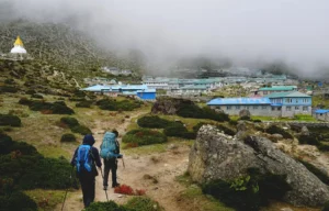
Gokyo has some of the best lodges in the upper Khumbu, with warm dining rooms, lake views and surprisingly varied menus. On the western side, facilities are much simpler.
Lungden has only one or two basic lodges, with small rooms, thin walls, and a yak-dung stove in the dining room; in the busiest weeks, they fill quickly. Marlung and Thame have a few more lodges, and Namche Bazaar offers bakeries, cafes and comfortable rooms. Our team books ahead wherever possible.
Meals are hearty: dal bhat, noodle soup, fried rice, potatoes, Tibetan bread and porridge, with Sherpa stew in some lodges. We recommend vegetarian food at altitude, plenty of hot drinks and soups, and no alcohol until after the pass.
Refill your bottles with boiled or purified water rather than buying plastic, and carry enough cash, as there are no ATMs beyond Namche and charging and hot showers are limited on the Lungden side. If comfort matters, the Everest Base Camp Luxury Lodge Trek and our guide to the luxury Everest Base Camp Trek show how the region’s finest lodges compare.
Safety on Renjo La and Backup Plans
The Renjo La Pass is safe for well-prepared trekkers in good conditions, but the mountains set the rules. Our guides follow a few simple principles:
- Start early and set a turnaround time: If you have not reached the top by late morning, or the weather closes in, your guide may decide to turn back.
- Never cross alone: The western side is remote, and you may meet few other trekkers.
- Respect ice on the steps: Use microspikes and poles, and take extra care in the shadows.
- Watch for rockfall: Do not linger below steep, loose slopes.
- Stay together in cloud: Snow and mist can hide the trail on the upper slopes.
- Have a backup plan: If the pass is closed, wait a day in Gokyo or walk back down the Gokyo Valley via Machhermo and Dole to Namche.
- Plan for emergencies: Helicopter rescue is possible in good weather, so your insurance must cover it.
Always book with a registered, experienced company; you can view our company registration and legal documents online and meet our guides on our team page.
Permits and Guide Rules for Renjo La
No special permit is needed for Renjo La itself. You need the two standard Everest region permits, and our team arranges both:
- Sagarmatha National Park entry permit: Checked at the park entrance at Monjo.
- Khumbu Pasang Lhamu Rural Municipality permit: Required to enter the local municipality area.
Our guide to Everest Base Camp Trek permits explains how they work, where they are checked and what to carry. Trekking rules in Nepal have changed in recent years, and many areas now require a licensed guide; rules vary by area and can change, so check before you travel.
Our article on Nepal’s mandatory guide rules explains the background. Whatever the rules, we strongly recommend a licensed guide on Renjo La: route-finding in snow, judging the weather, and recognising altitude sickness are all far safer with an experienced professional. Check entry requirements for Nepal in our Nepal visa guide.
Photography Tips for Renjo La
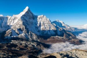
- Look back on the climb: The view of Everest above the lake grows with every switchback; stop on safe, flat ground to shoot.
- Mid-morning light: Because you look east towards Everest, the light is often best once the sun has climbed above the peaks.
- Go wide: A wide-angle lens or your phone’s panorama mode captures the lake, glacier, and mountains together.
- Use a polarising filter: It deepens the turquoise of Dudh Pokhari and the blue of the sky.
- Include people and prayer flags: They give scale to the vast landscape.
- Keep batteries warm: Store them in an inside pocket, as the cold drains them quickly.
- Drones need permission: Never fly a drone without the required official permission.
- Never stop in dangerous places: Avoid pausing on icy steps or below loose slopes.
Wildlife and Nature Around Renjo La
The Gokyo Lakes and their wetlands are protected as a Ramsar Site, a wetland of international importance, and the high valleys around Renjo La are home to hardy wildlife. Herds of Himalayan tahr graze the steep slopes, Tibetan snowcocks call from the rocks, and the Himalayan monal, Nepal’s colourful national bird, lives on the forested slopes lower in the valley.
Overhead, look for the huge bearded vulture, or lammergeier, and flocks of choughs riding the wind. The elusive snow leopard roams these valleys too, though very few trekkers are lucky enough to see one.
Plant life is sparse near the pass, but in autumn, gentians, edelweiss and dwarf rhododendrons add colour to the moraine, and juniper and birch appear as you descend towards Thame. The landscape of glaciers, lakes and moraine is a living lesson in how the Himalaya were shaped, and in how fast they are changing. Our Sagarmatha National Park guide explains the park’s wildlife and conservation in more detail.
Sacred Lakes and Sherpa Faith on the Route
For the Sherpa people, the Khumbu is a sacred hidden valley blessed by Guru Padmasambhava, and the Gokyo Lakes are holy waters, home to protective spirits. Hindu pilgrims also visit the lakes, especially during the full-moon festival of Janai Purnima in late summer. Please do not swim in the lakes or throw anything into them.
On the summit of Renjo La, you will see strings of prayer flags, each carrying prayers on the wind, and stone cairns built by passing trekkers and herders. Along the trails, mani walls carved with mantras and whitewashed chortens, explained in our article on the chorten in Tibetan Buddhism, mark the way.
Pass them with the stones on your right, walking clockwise as Buddhists do. The songs of the great yogi Milarepa are loved across the region, and the monasteries of Thame, Tengboche and Pangboche keep these traditions alive.
Responsible Trekking on Renjo La
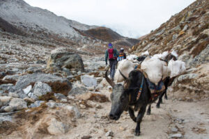
The lakes, moraines and pastures around Renjo La are fragile. Carry out all non-burnable waste, refill your water instead of buying plastic bottles, stay on the trail rather than cutting corners on the switchbacks and steps, and give way to yaks on narrow sections by standing on the uphill side.
Pack light so your porter’s load stays safe, buy locally made goods and stay in locally owned lodges, especially in Thame as it recovers. Learn more on our responsible tourism page.
Common Mistakes on Renjo La
- Starting late: Afternoon wind, cloud and soft snow make the crossing harder.
- Skipping acclimatisation: Especially when crossing from the Lungden side.
- Carrying too little water and food: There are no teahouses on the pass.
- Underestimating the descent: Almost 1,000 m of steep downhill lies between the pass and Lungden.
- Forgetting warm layers: The summit is cold and windy even on sunny days.
- No spare day: Weather can close the pass for a day or more.
- Ignoring your guide’s turnaround decision: The pass will still be there tomorrow.
Training for Renjo La
Start preparing three to six months before your trek. Build endurance with long hikes on hilly terrain carrying a daypack, stair climbing, cardio such as running, cycling or swimming, and strength training for your legs and core.
Train for the descent too: walking downhill on steep steps strengthens your knees and thighs for the long drop to Lungden. Our 12-week training plan is a good foundation; for the three passes, add more long, back-to-back hiking days.
If your time is limited, our guides to the short Everest Base Camp Trek and the Everest Base Camp Trek in 14 days show what you can achieve in less time, and our guide to how many days the EBC trek takes compares trek lengths across the region.
Luxury and Helicopter Options Around Renjo La
No luxury lodges sit on the western side of Renjo La. Still, the Gokyo side has some well-appointed rooms, and our team can upgrade your accommodation wherever better lodges are available.
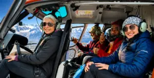
For a more comfortable taste of the Everest region, the Luxury Everest Base Camp Trek with Helicopter Return and the Everest Elite Luxury Heli Trek combine fine lodges with a flight out, and our guide to the luxury Everest View Trek shows you how to enjoy Everest views at gentler altitudes.
You can also see the Gokyo Valley from the air. The Gokyo Lakes Helicopter Tour flies over the turquoise lakes beneath Renjo La. At the same time, the Everest Helicopter Tour, the Mt Everest by Helicopter Tour,
the Sharing Everest Helicopter Tour with Kala Patthar Landing and the Everest Heli Sherpa Village Walk bring you close to the world’s highest mountain when operating. Before booking, read about Everest helicopter tour restrictions,
the best seasons for an Everest helicopter tour and the Kala Patthar landing. Our comparisons of the EBC trek or helicopter tour, the helicopter tour vs trek with helicopter return and our answer to whether a helicopter can land at Everest Base Camp explain the options, and the Everest mountain flight offers a quick view of the whole range from Kathmandu.
More Adventures in the Everest Region
Renjo La is only one of the Khumbu’s treasures. Walk in the footsteps of the first Everest expeditions on the Jiri to Everest Trek, described in our Jiri to Everest Base Camp guide, or skip the Lukla flight altogether on the Everest Base Camp Trek by Road.
Explore the quiet side of the valley on the Ama Dablam Base Camp Trekking, introduced in our Ama Dablam Base Camp Trek guide and our article on Ama Dablam, or slow down on the Everest Base Camp Yoga Trek, explained in our guide to mindful trekking in the Himalayas. Runners can test themselves on the Everest Marathon, and families will find gentler routes in our guide to the Everest Base Camp Trek with kids.
For climbers, the three passes are excellent preparation for Nepal’s trekking peaks. Consider Island Peak Climbing, described in our Island Peak climbing guide, Lobuche Peak Climbing or Mera Peak Climbing. Check the latest NMA peak permit updates when you plan, and read about bigger summits in our Ama Dablam expedition guide. For walking distances on the classic route, see our Everest Base Camp Trek distance guide.
Other Great High Passes in Nepal and Beyond
If crossing Renjo La leaves you wanting more, Nepal has many more passes to discover. The Annapurna Circuit crosses the Thorong La, with a possible detour on the Tilicho Lake Trek, and the Manaslu Circuit crosses the Larke Pass around the world’s eighth-highest mountain.
Remote adventurers can explore the Nar Phu Trek, the Upper Mustang Trek (introduced in our guide to trekking in Upper Mustang), the Lower Dolpo Trekking, the Kanchenjunga Base Camp Trek, and the Tsum Valley and Ganesh Himal Trek. Meanwhile, the Langtang Gosaikunda Trek combines the Langtang Valley Trek route with the sacred lakes of Gosaikunda.
Beyond Nepal, Bhutan’s legendary Snowman Trek crosses many high passes, as compared in our guide to the Everest Base Camp Trek vs Snowman Trek. Browse our list of the top 50 treks in Nepal and our complete trekking in Nepal guide for more inspiration.
Before and After Your Trek
After the cold and quiet of the high passes, Nepal’s lowlands and cities make a wonderful contrast. Explore the stupas and temples of the capital on our Kathmandu Day Tour, guided by our Kathmandu sightseeing tips, or watch the sun rise over the Himalaya on Nagarkot Hiking and the two-day Chisapani Nagarkot Trek.
Relax by the lake in Pokhara, described in our Pokhara sightseeing guide, with Paragliding in Pokhara, or head south for a Chitwan Jungle Safari or the Bardia National Park Tour. Adventure lovers can try Trishuli River Rafting, and the Classic Nepal Tour brings together the country’s heritage highlights.
Further afield, the Luxury Bhutan Tour leads to the cliffside Tiger’s Nest Monastery, and the Mount Kailash Tour circles the most sacred mountain in Asia.
Frequently Asked Questions About Renjo La Pass
How high is Renjo La Pass?
About 5,360 m (17,585 ft), almost exactly the height of Everest Base Camp. Some maps and GPS devices show slightly higher figures.
Is Renjo La Pass difficult?
It is the easiest of the Everest region’s three high passes, with no glacier, but it is still a strenuous six- to eight-hour day above 5,000 m that requires good fitness and acclimatisation.
How long does it take to cross Renjo La from Gokyo?
Usually three to four hours up to the pass and two to three hours down to Lungden, so six to eight hours in total with rest stops.
Which is harder, Renjo La or Cho La?
Cho La is generally harder and more technical because of the glacier on its summit. Renjo La is lower and has a well-made trail with no glacier.
Can you see Everest from Renjo La?
Yes. On a clear day, Everest rises above Gokyo Lake and the Ngozumpa Glacier, along with Lhotse, Makalu, and Cho Oyu.
What is the best time to cross Renjo La?
Autumn, from late September to November, and spring, especially April and May. Winter snow can close the pass, and the monsoon brings cloud and rain.
Do I need crampons or microspikes for Renjo La?
Crampons are not normally needed, but microspikes are very useful when the steps and upper slopes are icy, especially in early spring, late autumn and after snowfall.
Should I cross Renjo La from Gokyo or from Lungden?
We recommend crossing from Gokyo, east to west. You start higher and better acclimatised, and the climb is about 570 m instead of nearly 1,000 m.
Are there lodges at Lungden?
Yes. Lungden has one or two simple lodges, and Marlung and Thame have more further down the valley. There are no teahouses on the pass itself.
Can I cross Renjo La without doing all three passes?
Yes. A Gokyo and Renjo La loop takes around two weeks, or you can cross it as the grand finale of our 21-day Everest 3 Pass Trek.
Do I need a guide for Renjo La?
Rules vary by area and can change, so check before you travel. We strongly recommend a licensed guide for route-finding, weather decisions and altitude safety.
Final Thoughts: The Finest Finale in the Khumbu
The Renjo La Pass is the Everest region at its most beautiful and peaceful: a stone stairway into the sky, a view of Everest above a turquoise lake, and a quiet descent into the old Sherpa homeland of Thame. It asks for fitness, patience and respect for the mountains, and it gives back one of the greatest views on Earth.
Cross it as the grand finale of our 21-day Everest 3 Pass Trek, or ask us to add it to the Gokyo Lakes Trek. Prefer the classic route? Choose the Everest Base Camp Trek and let our guides show you the Khumbu. Learn more about our company, then plan your trip or contact us today: one pass, one view, a lifetime of memories.
Quick Inquiry
Explore More


